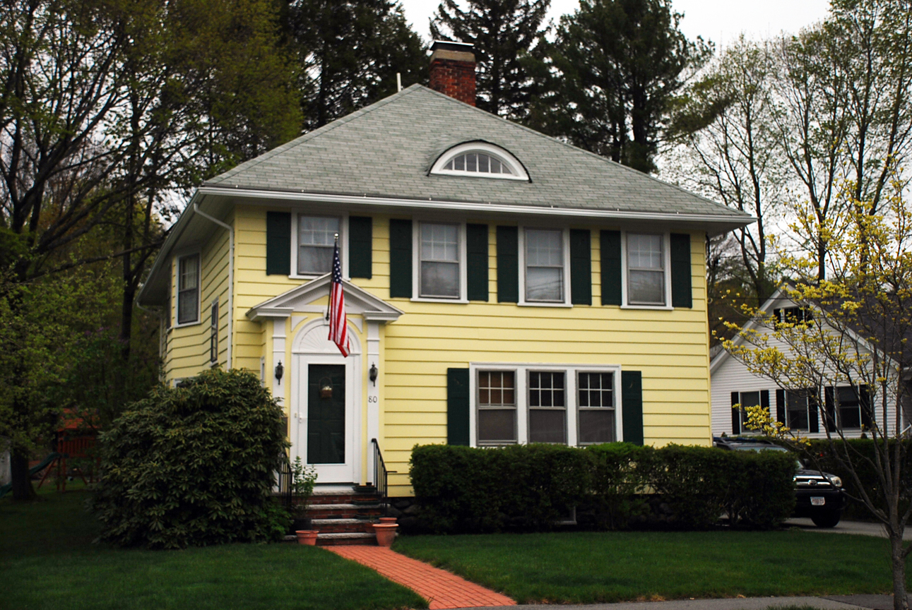
Architectural Description:
Four Square - Craftsman style
Eyebrow window, bay window on west side
Historical Narrative:
This property was once part of the Henry Pasho estate. After his death his heirs parceled off house lots. George Pasho sold the lot to Ella B. Dodge on Aug. 23, 1915. Dodge later bought an adjoining lot in May 1924 from Llewellyn D. Pomeroy. The property with house and two parcels was sold to Anna M. Daniels on June 21, 1929. The Daniels family owned the home for 34 years. Anna M.. Daniels died on Apr. 6, 1956 and her husband Roy A. Daniels inherited the property on Aug. 23, 1956. Their daughter Eleanor Tower, wife of Oswald Tower Jr., was deeded the property on June 14, 1963. Eleanor sold three years later to M. Elizabeth Foley on Feb. 4, 1966.
Bibliography/References:
Essex Northern Registry Deeds, Lawrence, MA
80 Chestnut
Map #757 June 1927 lot 2 Ella B. Dodge
Owners;
George H. Pasho –lot 2
Ella B. Dodge – Aug. 23, 1915 – b. 356 p. 236
Ella B. Dodge - May 5, 1924 – b. 503 p.7 from Llewellyn D. Pomeroy
Anna M. Daniels – June 21, 1929 – b. 547 p. 23 – two lots
Anna M.. Daniels estate, died Apr. 6, 1956, heir Roy A.– Probate #252332
Roy A. Daniels Aug. 23, 1956 – b. 839 p. 170 dau. Eleanor Towers
Eleanor D. Tower, wife of Oswald Jr. – June 14, 1963 – b. 987 p. 281
M. Elizabeth Foley – Feb. 4, 1966 – b. 1054 p. 190
John P. Shay – Sept. 1, 1966 – b. 1067 p. 289
Edward L. & Phillis M. Alexander – June 23, 1969 – b. 1133 p. 329
Elizabeth M. Steele & Sandra L. Steele – Sept. 13, 1977 – b. 1320 p. 84
John C. & Margaret A. Campbell – May 20, 1995 – b. 4344 p. 274
Matthew D. & Jennifer Asoian Healy – June 17, 1998 – b. 5094 p. 176
Thomas & Mary Beth Haut – Jan. 5, 2004 – b. 8501 p. 21
Inventory Data:
| Street | Chestnut St |
| Place | Andover Center District |
| Historic District | Not Applicable |
| Present Use | residence |
| Original Use | residence |
| Construction Date | 1915 - 1916 |
| Source | ECRDS, ENRDL, style-njs |
| Foundation | stone/granite |
| Wall/Trim | aluminium clapboard |
| Roof | asphalt - hip |
| Condition | excellent |
| Acreage | 0.210 acre |
| Setting | residential |
| Map and parcel | 22-1A |
| Recorded by | Stack/Mofford, James S. Batchelder |
| Organization | Andover Preservation Commission |
| Date entered | 1975-77, 5/12/2016 |

