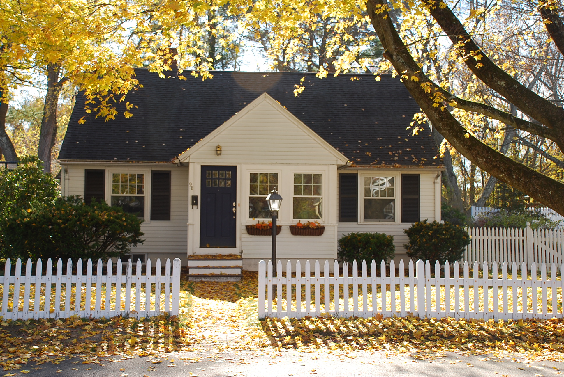
Architectural Description:
Colonial Revival - Cape
Bibliography/References:
Essex County Registry Deeds, Salem, MA
Essex Northern Registry Deeds, Lawrence, MA
Andover Maps, 1852, 1872, 1888, 1906, 1926
Andover Street Directories
Mills, Mergers and Mansions, by Edward Roddy 1982
Shawsheen Village 1922-1923 - Shepard on Burnham Rd.
See Map plan #704 - American Woolen Company - Sept. 1927
Map #735 - June 16, 1928 - lot 1
See #7 Argyle St. for Town Farm history
Goldsmith, Bessie, "Townswoman's Andover", 1964, pg. 94
Owners;
Samuel Abbot - 1804 - 90 acre farm
Inhabitants of Town of Andover - 1807 – 1921 – Town Farm
Varter & Havenes Dagdegian - July 11, 1921 - b. 443 p. 503
Town of Andover, Geo. C. H. Dufton - July 12, 1921 - b. 443 p. 505 - 13.66 A
Town of Andover, July 12, 1921 - Town Meeting Nov. 1, 1921 sell
American Woolen Co., Wm. M. Wood - July 11, 1921 - b. 443 p. 296 - 12.56 acres - lot 1
American Woolen Co.- Nov. 15, 1921 - b. 450 p. 342 - 10 acres- lot 2
Textile Realty Co., Lionel J. Noah, Pres. A.W.Co. - Dec. 30, 1931 - b. 563 p. 334
Andover Shawsheen Realty Co. - June. 30, 1932 - b. 565 p. 87 - 17th parcel
Eugene W. & Helen E. Jordon - July 23, 1945 - b. 675 p. 314
John R. & Sadie P. Sullivan - Dec. 17, 1957 - b. 866 p. 478
John R. Sullivan, Sadie P. Sullivan's estate - d. June 7, 1975
John R. Sullivan and Dorothy A. Valentine - July 21, 1975 - b. 1263 p. 730
John R. Sullivan estate, Dorothy A. Valentine heir, Aug. 22, 1976
Charles L. & Dorothy A. Valentine - Mar. 10, 1977 - b. 1304 p. 132
Dorothy A. Valentine estate, William R. Valentine, Extr -
Milton E. 7 Nancy K. Cranney - Mar. 12, 1992 - b. 3676 p. 167
Roland & Karen Kim - Aug. 15, 2002 - b. 7010 p. 280
Inventory Data:
| Street | Burnham Rd |
| Place | Shawsheen Village - Frye Village |
| Historic District | Shawsheen Village NRH District |
| Present Use | residence |
| Original Use | residence |
| Construction Date | 1940 - 1945 |
| Source | ERDS, ENRDL |
| Architectural Style | Colonial Revival |
| Foundation | stone |
| Wall/Trim | clapboard/wood |
| Roof | asphalt - gable |
| Condition | excellent |
| Acreage | 0.360 acre |
| Setting | residential |
| Map and parcel | 36-4 |
| Recorded by | James S. Batchelder |
| Organization | Andover Preservation Commission |
| Date entered | July 15, 2015 |

