
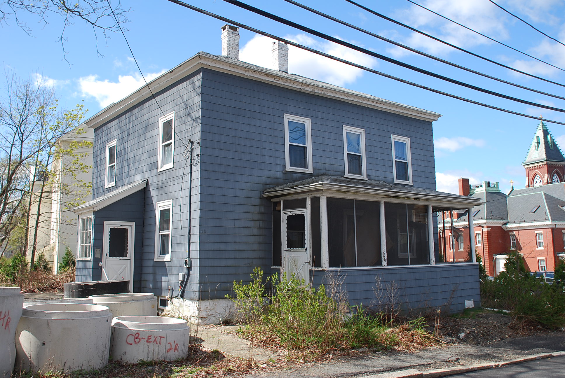
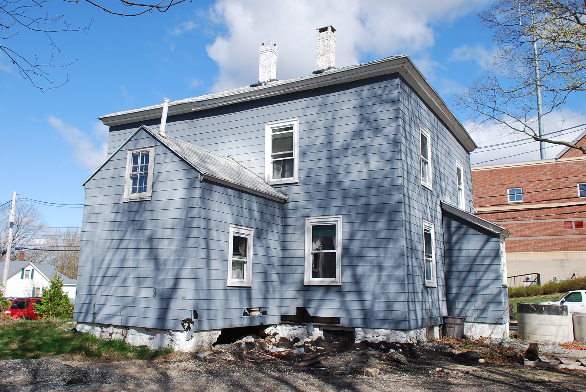
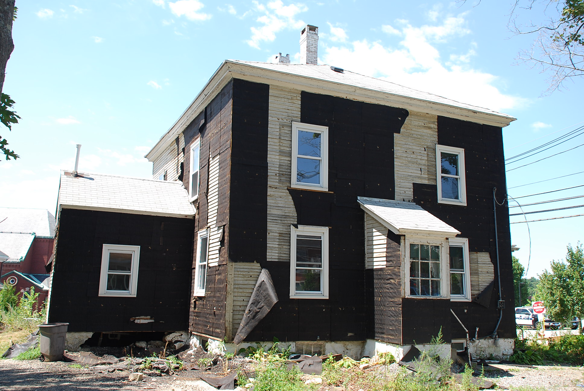
Architectural Description:
Four Square with hip roof
Historical Narrative:
The parking lot at this location today was the former site of the Layhee - Lonergan house that was purchased by the Town of Andover in 2007 and razed in 2010 for the construction of a municipal parking lot as was the adjoining lot at #16 Pearson St. once all one lot in the 1860s.
Pearson Street was named for the Rev. Eliphalet Pearson, L.L.,D, born 1752 in Byfield, Newbury, MA, graduate of Harvard in 1773, taught at Andover Grammar School in 1774, first Principal of Phillips Academy 1778-1786. In 1806 he helped found the Andover Theological Seminary. Pearson moved to Harvard, MA in 1820 and died on Sept. 12, 1826. It should be noted that the B&M Railroad had not yet been built, opened in 1848., but the Andover - Wilmington Railroad line 1838-1848 did cross on the upper east end of Pearson Street.
This property was once owned by Eliphalet Pearson. Pearson's land in Andover was sold by Trustees of his estate, Ephraim Abbot and Stephen Gardner, to Amos Abbott – Sept. 30, 1830 the third parcel of 100’ x 70’ x 100’ x 70’ which was 16 Pearson St. Amos Abbot's home was on North Main St. on the corner of Pearson St. now the site of the service station.
Bartholomew Carney, Laborer purchased #16 Pearson on July 3, 1839 and then the adjoining lot #18 measuring 55’x100’x55’x100’ from Thomas C. Foster, gentleman on Oct. 21, 1840 for $100. Carney would sell eleven years later to William P. Millett, tailor on Sept. 30, 1851 for $850. Charles Sugrue laborer bought on Mar. 21, 1855 for $600
followed by John & Margaret Barry on Oct. 31, 1863 for $850.
On Apr. 1, 1869 Barry sells #16 Pearson to Garrett & Hannah Cotter for $850 and then sell #18 Pearson St. to Patrick Layhee on July 26, 1869 for $1300 with dwelling house. It appears that John Barry had the home built on this lot sometime between 1863-1869. Patrick Layhee on July 26, 1869. The Patrick Layhee estate then sold the property to William Patrick Regan. The William Patrick Regan estate, with John William Taylor as executor of the estate on June 21, 1923 sells to
Michael & Bridget A. Lonegan on Dec. 31, 1925.
The Lonergan family own the property for 82 years. Michael Lonergan estate - with Mary Lonergan Lane, executrix Apr, 26, 1939. Mary through probate became the owner of the property and owned for 68 years.
Mary Lonergan Lane sold the property to the Town of Andover on Aug. 22, 2007.
Bibliography/References:
Essex Northern Registry Deeds, Lawrence, MA
Essex County Registry Deeds, Salem, MA
Map #14058 parcel B
Owners;
Rev. Eliphalet Pearson
Rev. Eliphalet Pearson estate, Sept. 12, 1826, Ephraim Abbot & Stephen Gardner, Trustees
Amos Abbott – Sept. 30, 1830 – b. 262 leaf 20 – 3rd lot 100’ x 70’ x 100’ x 70’
Bartholomew Carney, Laborer - July 3, 1839 - bk. 314 leaf 106 – lot 100’x70’xx100’x70’
Thomas C. Foster, gentleman, west of Carney’s land
Bartholomew Carney, yeoman - Oct. 21, 1840 - bk. 321 leaf 174 $100 lot -55’x100’x55’x100’
William P. Millett, tailor - Sept. 30, 1851 - bk. 462 leaf 261- $850
Charles Sugrue laborer - Mar. 21, 1855 - bk. 509 leaf 271 - $600
John & Margaret Barry - Oct. 31, 1863 - bk. 658 leaf 223 - parcel #1- $850
Patrick Layhee - July 26, 1869 - b. 778 leaf 224 - $1300 – w/dwell. lot size change
Patrick Layhee estate probate #77434
William Patrick Regan
William Partick Regan estate, John William Taylor, extr. June 21, 1923
Michael & Bridget A. Lonegan - Dec. 31, 1925 - b. 519 p. 204
Michael Lonergan estate - Apr. 26, 1939 - probate #193080
Mary Lonergan Lane, extrx Apr, 26, 1939
Alan T. Polegreen - Apr. 29, 1939 - b. 622 p. 362
Mary Lonergan Lane - May 1, 1939 - b. 622 p. 363
Mary Lonergan Lane & Daniel J. Kane - May 21, 1962 - b. 960 p. 127
Mary Lonergan Lane - June 14, 2001 - b. 6220 p. 185
Town of Andover - Aug. 22, 2007 - b.10884 p. 142
Inventory Data:
| Street | Pearson St |
| Place | Andover Center |
| Historic Name | Layhee - Lonergan House |
| Present Use | Municipal parking lot |
| Original Use | residence |
| Construction Date | 1860's |
| Source | ERDS, ENRDL |
| Architectural Style | Other |
| Foundation | stone/granite/brick |
| Wall/Trim | clapboards/asbestos shingle covering |
| Roof | asphalt - hip |
| Condition | Razed 2010 |
| Demolished? | Yes |
| Demolition Details | 2010 |
| Acreage | 0.14667 acre |
| Setting | residential/commerical |
| Map and parcel | 55-75 |
| Recorded by | James S. Batchelder |
| Organization | Andover Preservation Commission |
| Date entered | Jan. 9, 2015, 5/8/2017 |


