Architectural Description:
Style: Federal style
Corner pilasters now covered
Historical Narrative:
Present owner: James S. Pierro Jr. Aug. 2004.
Themes: Architectural, Community development, Industry, Religion
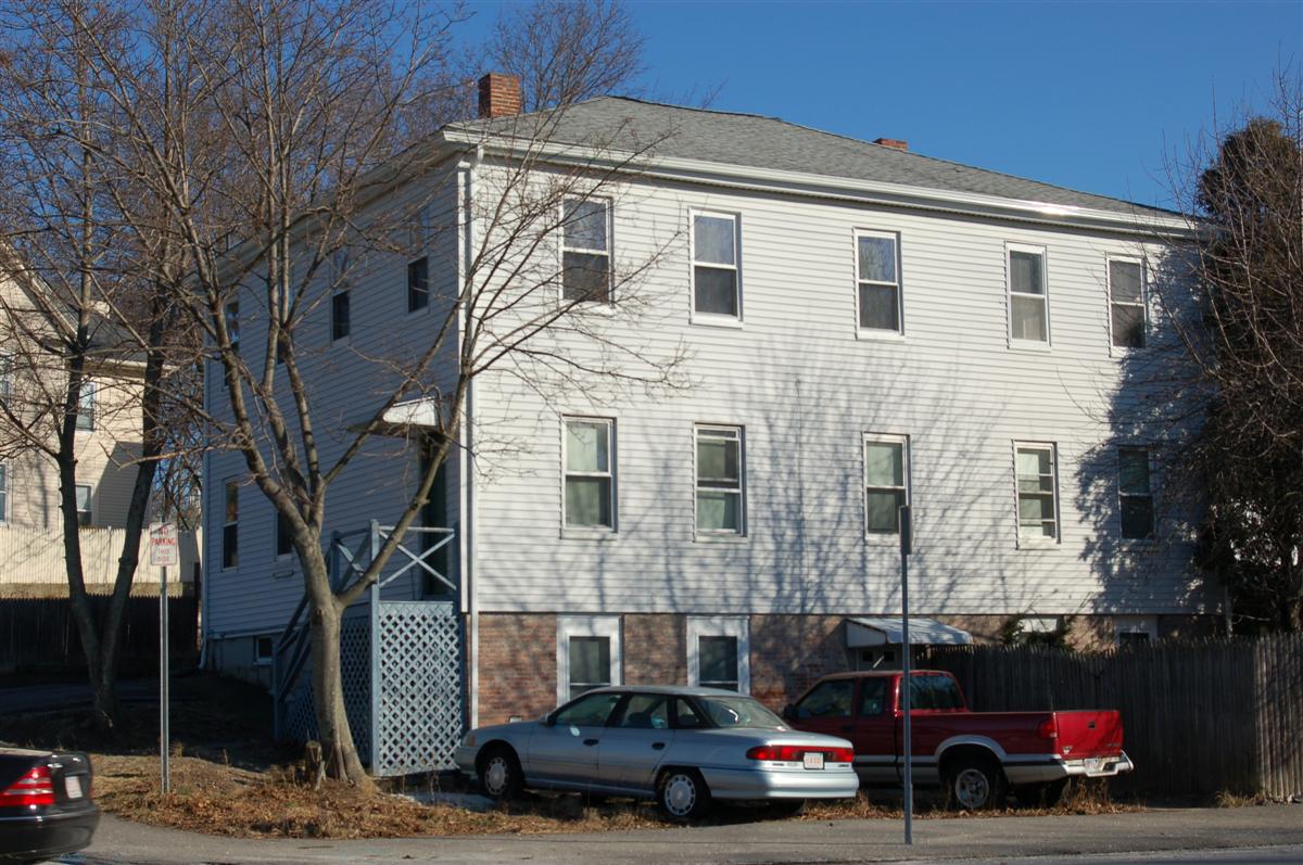
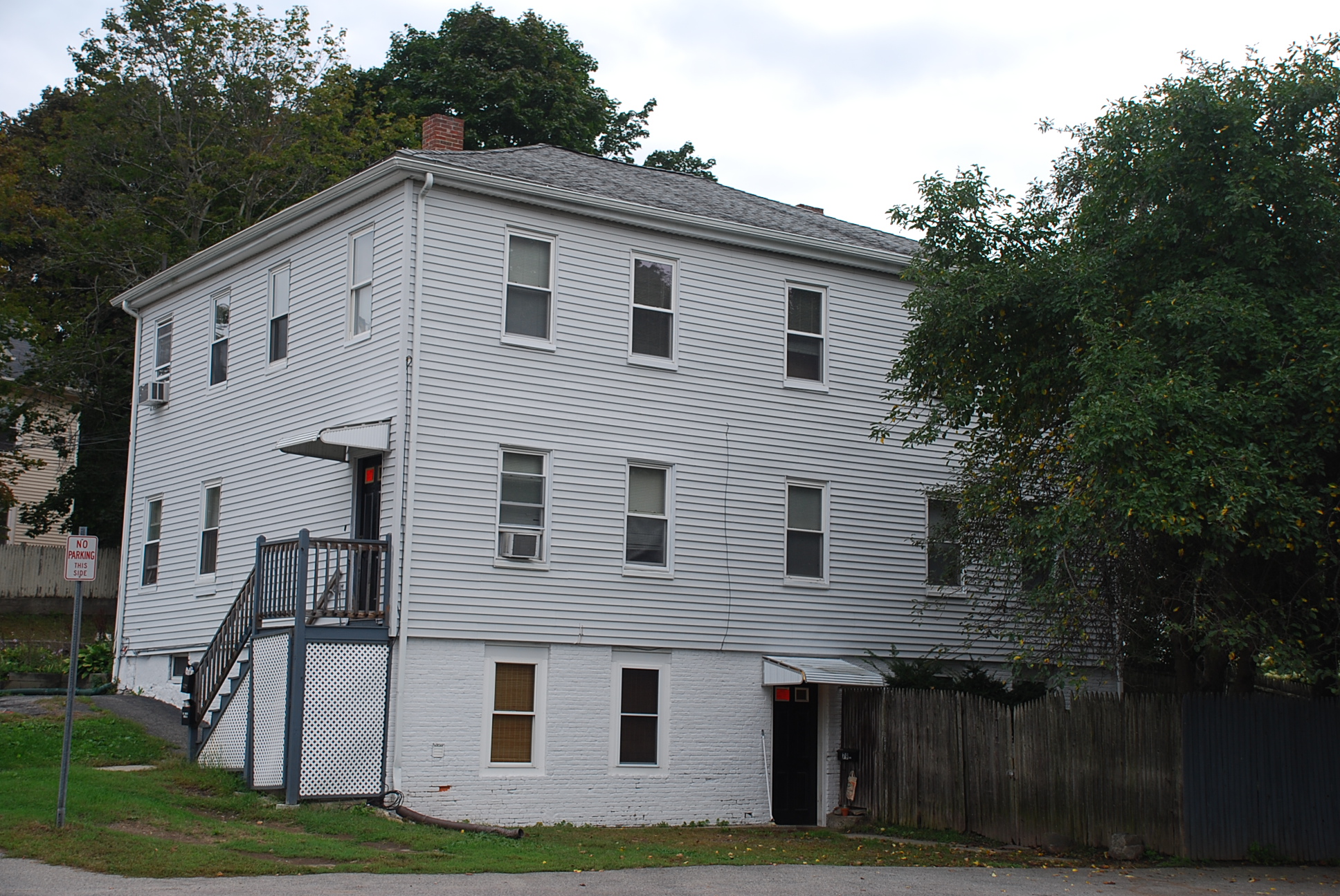
18 Ridge Street – Mark H. Newman House
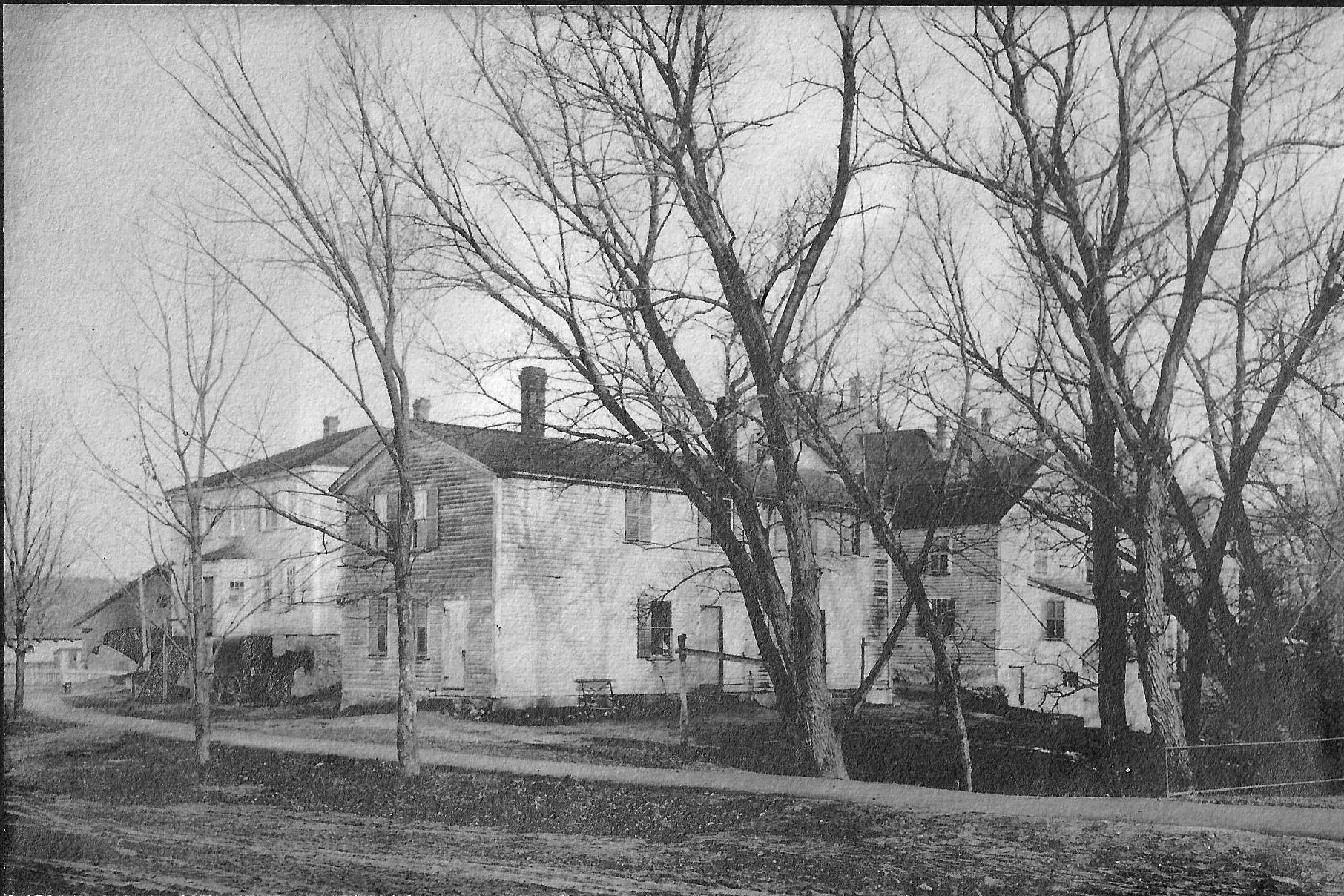
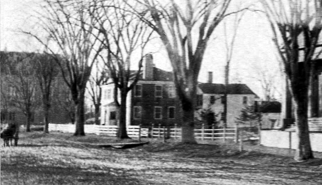
The Deacon Mark H. Newman house once stood on the corner lot of Central & School Streets where the current Episcopal Church building is now located. The house is a Federal period structure which had its center main entrance facing Central St. and two large wings off the rear of the house. It is said Newman boarded boys from Phillips Academy here. Mark was married twice, first to Sarah Phillips and then to Abigail Dodge. Mark died on June 15, 1859. His daughters Margaret Newman and Hannah N. Fay sold the house and property to the Proprietors of Protestant Episcopal Church also known as Christ Church Parish on November 21, 1885 for $6000. The next month the Christ Church Parish put the Newman house up for auction provided it was moved off the site.
Dec. 11, 1885 Andover Advertiser (AA) p2 – The Henry [sic] Newman house, corner of School &Central Streets will be sold at public auction tomorrow afternoon at 3’ o’clock.
Dec. 18, 1885 AA p9 The Mark Newman house was sold last Sat. to Mr. Dennis O’Brien. Mr. Dennis O’Brien has purchased two house lots on School Street, near the B & M Station of Messrs Abbott & Jenkins; he intends moving his Mark Newman house to that place.
O’Brien did purchase the lot of land at the corner of Ridge and School Streets and moved the house and the two back additions down to this location. The main house was placed on a high ground floor cellar foundation and the two wings were placed on a lot to the east and north of the house creating three separate buildings for tenement housing. Today houses numbers #14–16 and #18 Ridge St and #77 School St. comprise the original parts of Newman house. O’Brien converted all three structures into income rental apartments with the plan to rent to workers at the mills of the Smith & Dove Manufacturing Co. and the Tyer Rubber Co. nearby.
John J. Sweeney purchased the properties in 1900 and held to his death. The Sweeny heirs sold to Patrick Daly in January 1929 and the Daly family held the property for 28 years. It sold to Westport Realty Trust in Jan. 1957. Westport Realty Trustees were; Guy B Howe and Amita M. & Charles P. Howe of Andover. The property was surveyed in August 1959 and a map Plan #4034 divided up the lot and houses into four separate lots including #75 School St. Westport Realty Trust sold in 1964 to Suburban Household Enterprises, Inc. John R. Daly, Trustee.
In the next decade five more owners would hold the property. On May 28, 1974 Torrisi & DiFiore Inc. Raymond E. DeFiore Pres. bought the property and sold off #77 School St. to Rosalie V. E. Dodd in July 1977. Torrisi & DeFiore then sold to Ralph A. & Marie Barbagallo Jr. Trustees in 1977. They would sell off #75 School St. to Michael K. & Eileen A Broderick on Aug. 31, 1978. The remaining two lots of #14–16 and #18 Ridge St., the original Newman homestead, were later sold to Massih & Denise A. Massihzadegan in Oct. 1979. Who held for 26 years. James S. Pierro Jr. purchased the properties in Aug. 2004.
Bibliography/References:
See Bessie Goldsmith
Essex Northern Registry of Deeds, Lawrence
Essex County Registry of Deeds, Salem, MA
Andover Advertiser 1885.
Owners;
Isaac Howarth - land
John Dove – July 13, 1852 – b. 464 leaf 159 Salem deeds - land
Isaac E. Giddings – Jan 1, 1874 – b. 25 p. 168 – land. Lawrence, deeds
Isaac Giddins estate, heir sister Hannah E. Giddins by will
George L. Abbott & William S. Jenkins – Aug. 4, 1877 – b. 47 p. 245 land
Dennis O’Brian - - Dec. 17, 1885 – b. 84 p. 342 – parcel of land for Newman house
John J. Sweeney – May 26, 1900 – b. 177 p. 298 - $2670 at auction
Katherine P. Sweeney – Sept. 11, 1911 – b. 310 p. 45
John J. Sweeney – Feb. 6, 1925 – b. 509 p. 219 – second parcel
John J. Sweeney Estate, Catherine Sweeney Extrx. – Feb. 20, 1929 Probate
Patrick Daly – Jan. 1, 1929 – b. 545 p. 134
Patrick Daly estate – d. May 31, 1943
Patrick Daly estate, John R. Daly Trustee - Apr. 9, 1947 - Probate
Westport Realty Trust, Guy B. & Anita Howe Jr., Marion Young, tr – Jan. 27, 1957 - b. 887 p. 484-5
Suburban Household Enterprises, Inc. John R. Daly Trust – Apr. 4, 1960 – b. 912 p. 416
Ernest & Elvira C. Kaufman – Dec. 1, 1964 – b. 1023 p. 459
Empire Realty Trust, Sebastian & Anna Corzo & Ernest & Elvira Kaufman – Dec. 1, 1964 – b. 1023 p. 459
Empire Realty Trust, Sebastian & Anna Corzo – Feb. 21, 1966 – b. 1055 p. 20
Paul V. & Antonia Meli – Nov. 1, 1967 – b. 1094 p. 166 - 167
Meli Realty Trust – Paul & Antonia Meli, Trs. – Aug. 11, 1972 - b. 1199 p. 529 all 4 parcels
Torrisi & DiFiore Inc. Raymond E. DeFiore pres. – Aug. 11, 1972 – b. 1199 p. 529, parcels 12-13-14-15
Torrisi & DiFiore Inc. Raymond E. DeFiore pres. – May 28, 1974 – b. 1241 p. 486 – 489
Alfred Realty Trust – Oct. 24, 1977 – b. 1322 p. 583 – 3 parcels #75 School St., #14-16 & #18 Ridge St.
Lincoln, Inc. Ralph Barbagallo Jr. pres. – Dec. 19, 1978 – b. 1360 p. 12
Alfred Realty Trust, Ralph & Marie Barbagallo Jr. – Oct. 26, 1979 – b. 1400 p. 113
Massih & Denise A. Massihzadegan – Oct. 26, 1979 – b. 1400 p. 114
James S. Pierro Jr. – Aug. 31, 2004 – b. 9027 p. 129
Inventory Data:
| Street | Ridge St |
| Historic District | Not Applicable |
| Historic Name | Newman House |
| Present Use | residence |
| Original Use | residence |
| Construction Date | 1820's |
| Source | ENRD - Lawrence, MA |
| Architectural Style | Federal |
| Foundation | stone and brick |
| Wall/Trim | wood clapboards, coverd vinyl sided |
| Roof | asphalt |
| Outbuildings / Secondary Structures | two small houses at 14-16 Ridge St. containing one unit each. |
| Major Alterations | Windows replace, Vinyl siding covering original wood clapboards. Original front entry door removed at an earlier date nearer 1900 |
| Condition | fair |
| Moved? | Yes |
| Move Details | 1885 |
| Acreage | less than one acre; 6550 sq. ft.; approx. frontage: School 70', Ridge 73' |
| Setting | residential/commerical |
| Map and parcel | 55-32A |
| Recorded by | N. J. Stack/Mofford, James S. Batchelder |
| Organization | Andover Preservation Commission |
| Date entered | 1975 - 1977, 3/2914 |


