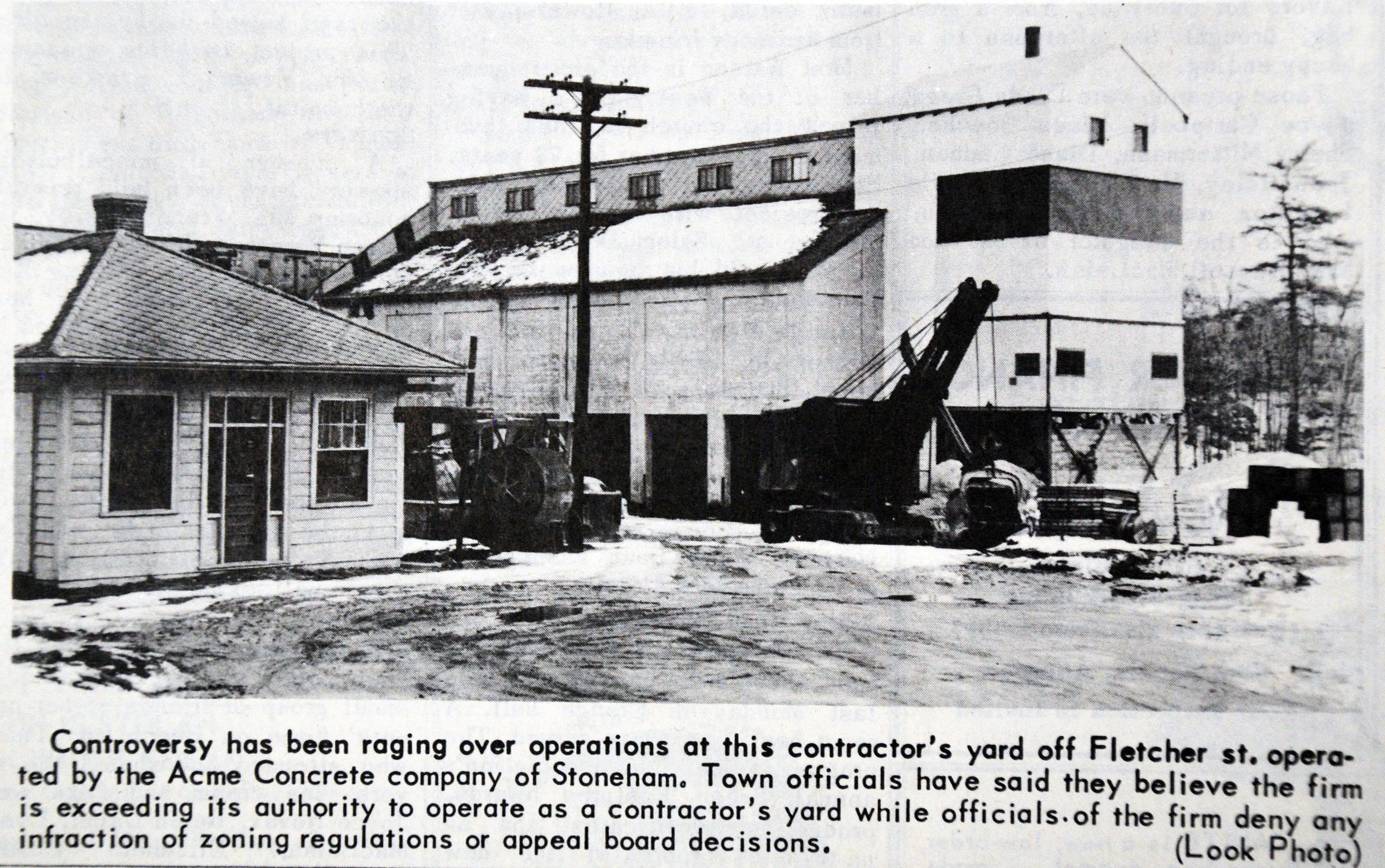
Architectural Description:
Office building, wood construction, hip roof, clapboard exterior. with bay windows on either side for trucks entering or exiting.
Historical Narrative:
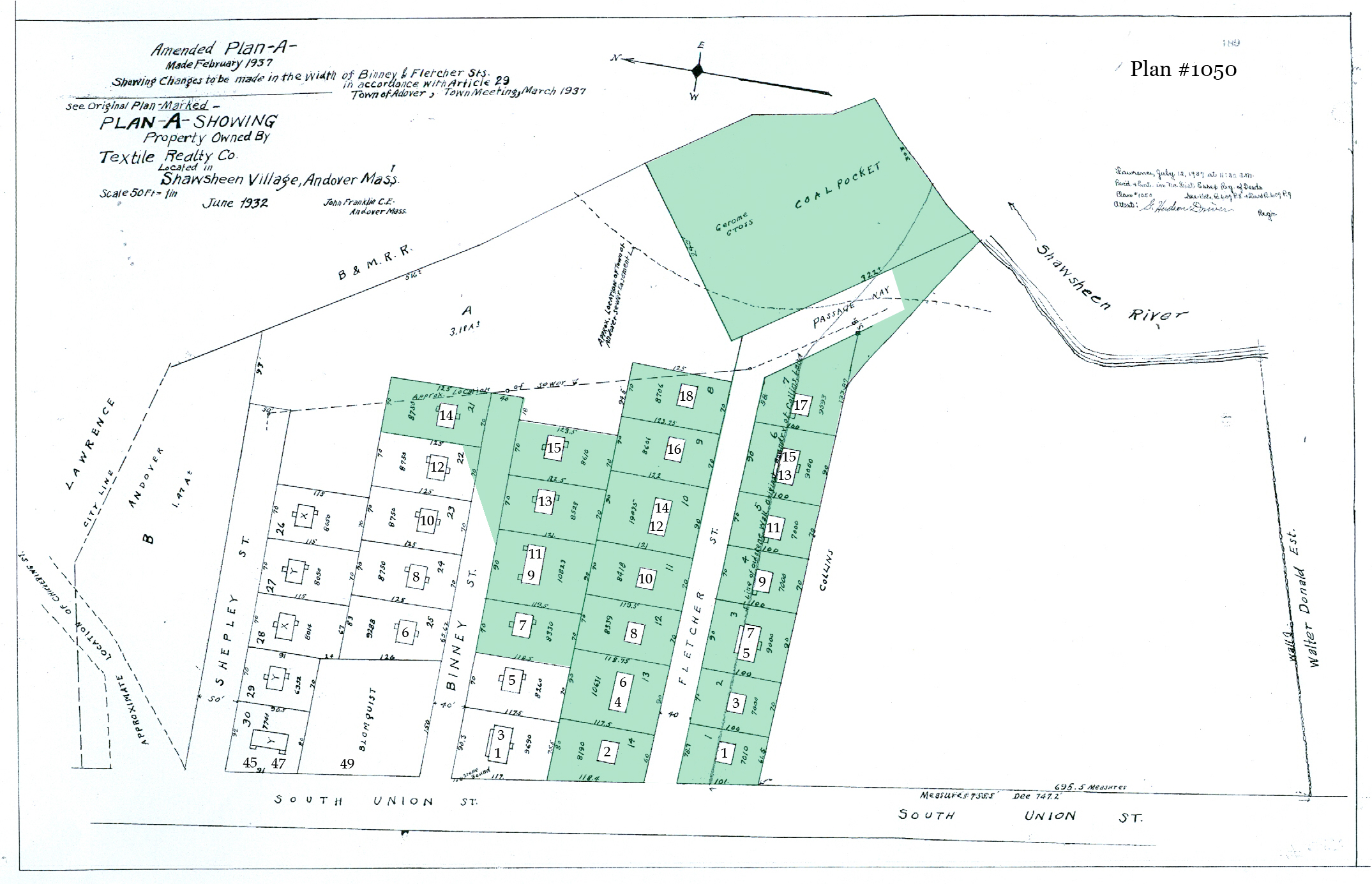
21 Fletcher St. Coal Pocket - Cement Co.– 9-91 – 1.54 acres –
At the end of Fletcher Street was a 1.54 acre lot that abutted the B&M Railroad tracks. The 1926 Street index of Fletcher Street lists B. L. McDonald Co. coal pocket. A spur line off the main rail line tracks allowed for coal cars to be delivered at this location, unloaded into large coal pockets or bins. Bernard L. McDonald was co-owner the McDonald Coal Co. with his brother John H. McDonald, who was Andover’s Postmaster at that time. Bernard was the treasurer and the business was located in Lawrence and had an office at 58 Main Street in Andover.
The property at that time was still owned by the American Woolen Co. who deeded the property to the Textile Realty Co. for liquidation of their properties. The lot was sold to Jerome Cross on May 27, 1932. Cross took a $10,000 loan from the Lawrence Savings Bank. The Cross Coal Co. operated their business operations from this location. There were no property restrictions in place on the deed other than “right of passage” and water rights to the Shawsheen River held by the Textile Realty Co.
Jerome Cross died in 1944 and his estate when to his children who sold the coal pocket to the Cross Coal Co. of Lawrence in 1944. The Acme Concrete Co. of Stoneham, MA, Walter Thomas, president, purchased the lot on Sept. 9, 1955. In February 1956 the Town stopped operations of the Acme plant as a violation of the town By-laws. They had originally said they would be creating concrete forms and blocks. Then stated it was a “Contractors Yard” used as storage of equipment and products of cement and sand. Aproval was finally given for the yard in April.
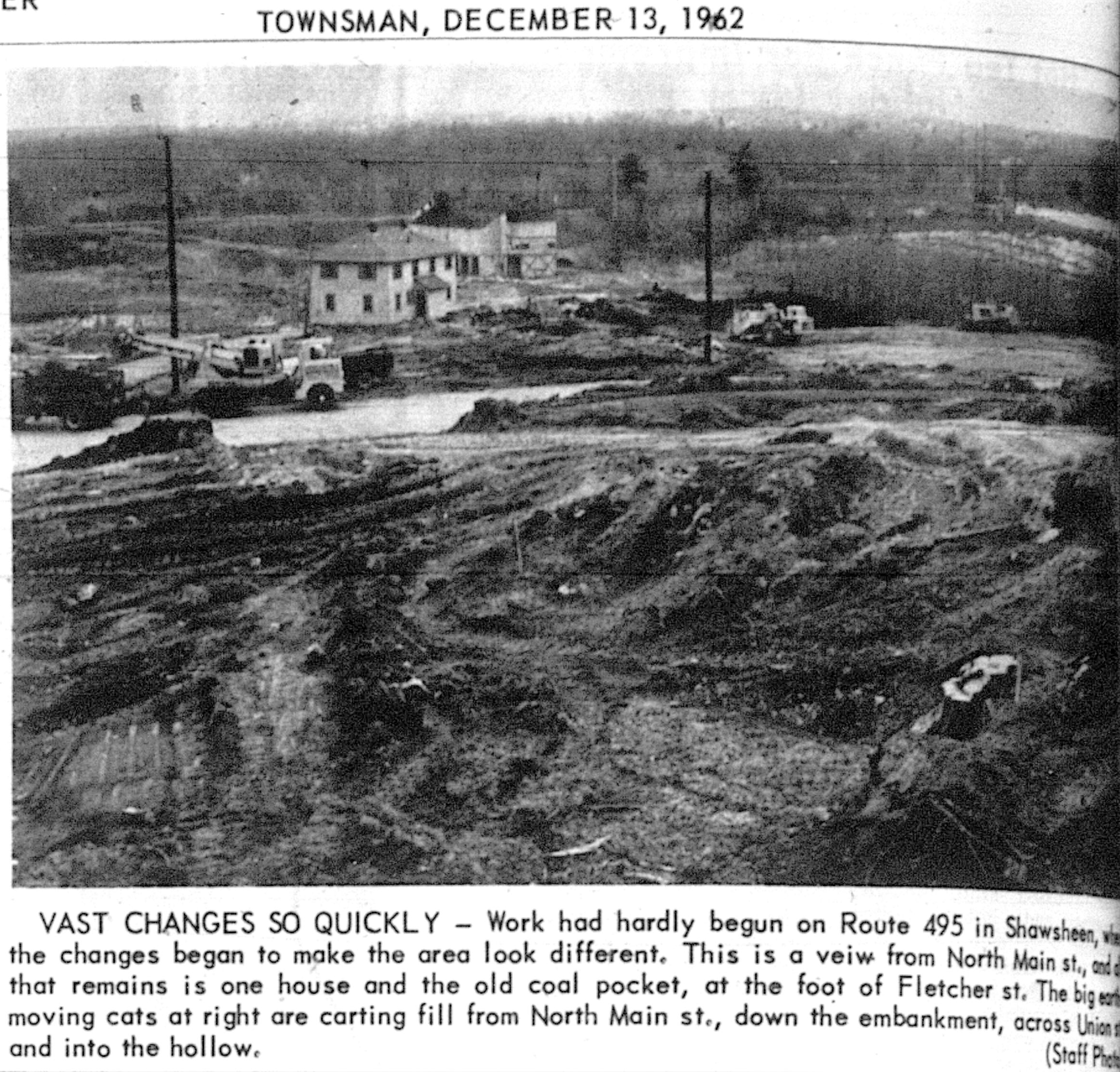
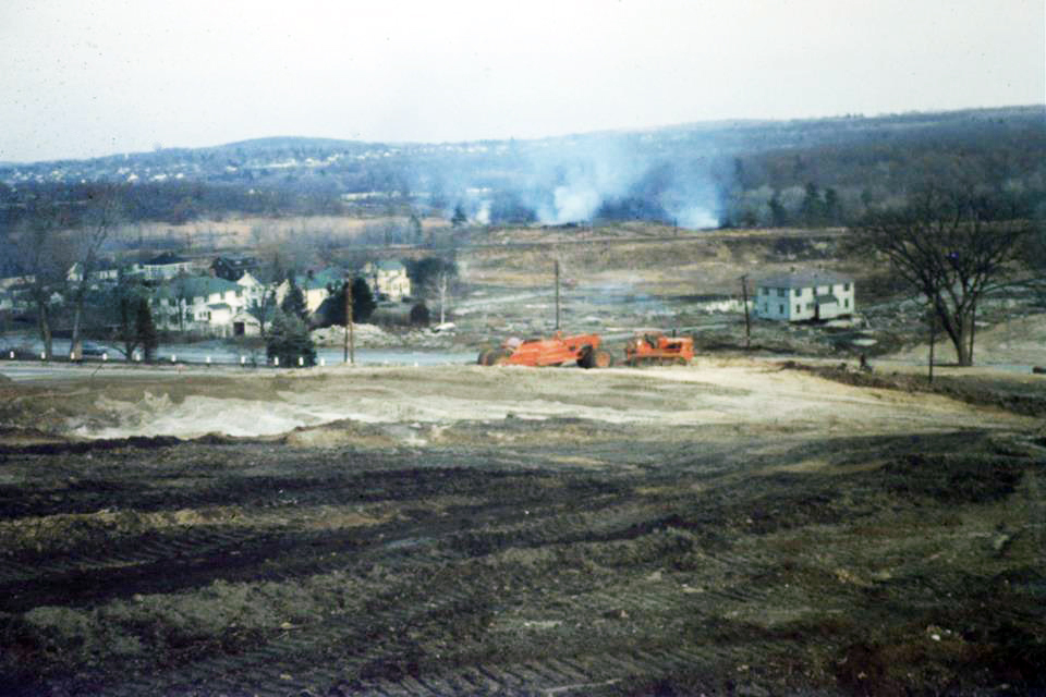
Acme later sold to Realty Developing Co. Inc. of Watertown on Nov. 30, 1956. Andowhitt, Inc. took ownership in April 1957 and two years later Wakefield Ready Mix Concrete Co. purchased the plant on June 6, 1959 then transferred to Whitten Concrete on June 16, 1959. Commonwealth of Massachusetts took the property by eminent domain on Dec. 29, 1960 for the construction of route 495. The structures were razed in 1962.
.
Bibliography/References:
1926 Directory – B. L. McDonald Co. Coal Pocket
Ephraim Everson parcel 1 & Solomon Flagg parcel 2
William C. Donald - March 3, 1855 - b. 567 leaf 246 - parcel 1 Salem deed
William C. Donald - Jan. 15, 1861 - b. 623 leaf 128 - parcel 2 Salem deed
William C Donald estate, Gordon Donald, TR - 9.86 acres
Henry P. Binney - Apr. 24, 1919 - b. 398 p. 52 - 9.86 acres
American Woolen Co. – Dec. 30, 1920 – b. 435 p. 215
Textile Realty Co. – Dec. 30, 1931 – b. 563 p. 229
Jerome Cross – May 27, 1932 – b. 564 p. 191 – Fletcher St. – p. 188 mtg.
Jerome Cross estate, Cross Coal Co. – Oct. 16, 1944 – b. 668 p. 433
Heirs Agnes B. Cross, Eve C. Glendening Jerome W. Cross Jr. Julie S. Musk
Cross Coal Co. of Lawrence, - March 7, 1956 – b. 830 p. 60 ASR
Acme Concrete Inc. of Stoneham, MA – Sept. 9, 1955 – b. 819 p. 473 see waiver b. 819 p. 471
Realty Developing Co. Inc. Watertown, MA – Nov. 30, 1956 – b. 852 p. 79
Andowhitt, Inc. – April 1, 1957 – b. 852 p. 79
Wakefield Ready Mixed Concrete Co., Inc. – June 6, 1959 – b. 895 p. 337
Whitten Concrete, Inc. – June 16, 1959 – b. 895 p. 342 mtg.
Commonwealth of Massachusetts – Dec. 29, 1960 – b. 929 p. 334-352 Eminent Domain
Inventory Data:
| Street | Fletcher St |
| Place | Shawsheen Village |
| Historic District | Not Applicable |
| Historic Name | Cross Coal Co. pocket - Acme Concrete Inc. |
| Present Use | Highway Route 495 |
| Original Use | Commercial coal storage |
| Construction Date | 1926 |
| Source | ECRDS, ENRDL, |
| Foundation | concrete |
| Wall/Trim | clapboard/wood/metal |
| Roof | asphalt/hip |
| Outbuildings / Secondary Structures | Coal pocket storage building later converted for concrete production |
| Condition | Razed 1962 |
| Demolished? | Yes |
| Demolition Details | 1962 |
| Acreage | 1.54 acres |
| Setting | residential/commerical |
| Recorded by | James S. Batchelder |
| Organization | Andover Preservation Commission |
| Date entered | April 10, 2023 |


