Architectural Description:
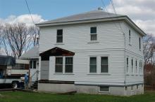
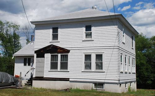
Craftsman's style or Prairie style - Four Square
Historical Narrative:
Themes: architectural, community development
The Town of Andover gained a right of way through the property of Isaac L. Farnham on July 11,1898 for the construction of the town’s sewer system and filter beds for leeching. The road was named Filter Bed Rd. from Haverhill St. to its terminus at the beds to the northwest. The south end of the street from Sutherland to Haverhill Streets was renamed Liberty St., first appears in town directories in 1930. The only property on the road was #5 Liberty which was formerly 78 Haverhill St. Soon after #6 Liberty appears which is now #21 Liberty. The number was changed in 1978 after the construction of two new homes on the west side of the street, now 6 & 8 Liberty. #21 on the east side of the street and north of Sutherland St. was re-numbered to maintain the practice of odd numbers on the right and even on the left as one drives in from the center of town.
This property was once owned by Isaac Wilson of North Andover (North Parish) and was part of a 14 acre wooded parcel on the north side of the road leading from Frye Village to North Andover, now called Haverhill Street.
The land was inherited by Abiel Wilson and Susan P. Green in June 1879. Susan acquired twelve parcels of land from the estate including lots in North Andover, Frye Village, West Parish and South Lawrence totaling nearly 180 acres. Isaac L. Farnham and his brother Charles H. Farnham purchased two parcels of about 22.4 acres in Frye Village from Mrs. Green in August 1880. Charles later inherits the property after Isaac’s death.
Charles Farnham sells a part of the land to Emeric Pariseau in 1902 and the 14 acres to John B. Warwick in Feb. 1904. Warwick further divides the property selling 5 acres to the American Woolen Co. in Oct. 20, 1920. This area is then developed into the extreme northeast section of the new Shawsheen Village neighborhood. Map #708 published in 1927 at the Registry of Deeds in Lawrence shows Haverhill St, Filter Bed Rd., Enmore St. and Carlisle St. #76 Haverhill St. is listed as parcel lot #22. A later map #877 June 1932 lists the lot as #38.
The 1922 map of Shawsheen Village lists this house as the old Warwick property. When the American Woolen Co. acquired this property in 1920 the house was then updated and painted white with green shutters to blend in with the new look of this section of the Village.
Warwick then sells another 6 acre parcel to Emeric Pariseau on Sept. 21, 1904. Pariseau takes a mortgage through Thomas E. Bowler of North Andover. Bowler was awarded the land via land court on June 21, 1907 and then sells off the six acre parcel to Thomas T. Clark on June 26, 1907. Clark developed along Stirling St. three duplex homes and then built this home to the rear of the property off Filter Bed Road. The south end of the street was re-named Liberty St. about 1929 as it appears in the 1930 Directory for the first time.
The only person living on Liberty St at #6 in 1930 - 1935 was Earl D. & Helen M. Batchelder. Earl was a Serviceman and later work for the American Woolen Co. Clyde & Anne Barlow followed at #6 from 1935-1943. In 1947 Wilbur T & Elizabeth R. Clark are residing at #6 Clark Rd. Wilbur b. 1906 and Elizabeth b. 1915 would later inherit the home now listed as 21 Liberty Street.
Bibliography/References:
Essex County Registry Deeds, Salem, MA
Essex Northern Registry Deeds, Lawrence, MA
See Land Court - Maps - #1726 - B March 1932 and #1726 - J Aug. 1978
Owners;
Isaac Wilson of North Andover - woodland
Isaac Wilson estate; Susan P. (Wilson) Green heir
Issac L. Farnham - Aug. 7, 1880 - b. 80 p. 252 - 14 acre portion
Issac L. Farnham estate, Sarah M. Farnham & Charles H. Farnham heirs
Emeric Pariseau - Sept. 11, 1902 - b. 197 p. 367 - 22.4 acre
John B. Warwick - Feb. 12, 1904 - b. 209 p. 131
Emeric Pariseau - Sept. 20, 1904 - b. 215 p. 42
Thomas E. Bowler - Sept. 21, 1904 - b. 215 p. 44 mtg deed
Emeric Pariseau - Sept. 21, 1904 - b. 215 p. 46 - 6 acres
Thomas E. Bowler - April 21, 1907 - Certificate # 165 - land court
Thomas T. Clark, wife Louisa A. - June 26, 1907 - Ctf. #166
Thomas T. Clark estate, Louisa A heir, - June 25, 1946 - probate
Louisa A. Clark estate - Feb. 25, 1950 - Clark heirs; Wilbur T., Lincoln D., Phyllis L. C. Dufton
Lincoln D. Clark and Phyllis L. C. Dufton - Nov. 26, 1979 - Ctf. #8374 - quit claim
Elizabeth R. Clark - Jan. 7, 1980 - Ctf. #8404
Elizabeth R. Clark & Lincoln O. Clark - Dec. 20, 1984 - Ctf. # 9598
Lincoln O. Clark - Sept. 24, 1991 - Ctf. #11201
Lincoln O. Clark - Feb. 28, 1995 - Ctf. Doc. 60590-1 - 2.12 acres
Inventory Data:
| Street | Liberty St |
| Place | Shawsheen Village - Frye Village |
| Historic District | Shawsheen Village NRH District |
| Historic Name | Thomas T. & Louisa Clark House |
| Present Use | residence |
| Original Use | residence |
| Construction Date | 1921 - 1922 |
| Source | ERDS, ENRDL, assessers' rec./style-njs |
| Architectural Style | Craftsman/Bungalow |
| Foundation | stone |
| Wall/Trim | cedar shingle/wood |
| Roof | asphalt - hip |
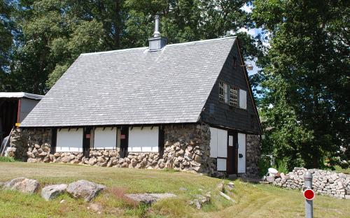
| Outbuildings / Secondary Structures | field stone and wood barn / shop |
| Major Alterations | Front entry porch removed, replacement windows, side ell addition |
| Condition | good |
| Acreage | 2.12 acres |
| Setting | residential |
| Map and parcel | 18-68 |
| Recorded by | Stack/Mofford, James Batchelder |
| Organization | Andover Preservation Commission |
| Date entered | 1975 - 1977, 8/26/2015 |


