Architectural Description:
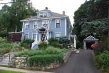
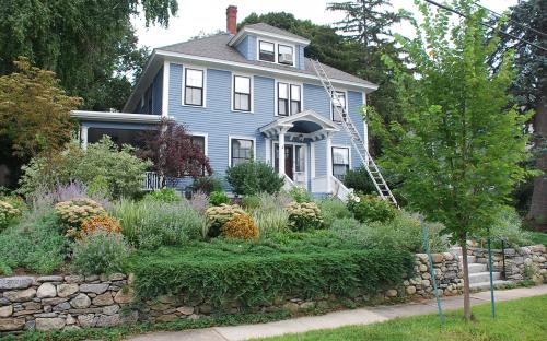
This home would be listed as a Colonial Revival home built from about 1905 - 1915 and is known as the "American Four-Square" The boxy form with hip roof above wide eaves and including one or two dormers, is derived from early prairie house designs of Frank Lloyd Wright. The Four Square has been adapted to many different forms from Classical style to minimal design elements. “Variations on a theme” to suit the owners taste and budget.
Historical Narrative:
Wolcott Ave
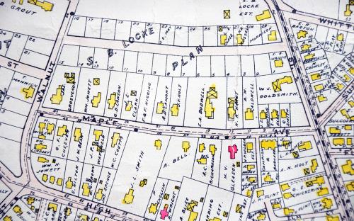
Wolcott Avenue was laid out in March 1902 by engineer John E. Smith Map #96. It is said to have been named for Governor Roger Wolcott former Lt. Governor 1893-1897 and then Gov. from 1897-1900. The street had 29 house lots and was a portion of the 25 acre Samuel B. Locke estate at 70 Elm St. The farm extended down to Maple Ave and was bounded by Walnut and Elm Streets. Anne H. Locke, wife of Samuel B., held the deed on Apr. 12, 1876. Anne sold off some of the first lots on the Ave before naming her daughter Florence M. Locke her Trustee on June 2, 1909. Florence then had charge of selling the remaining house lots. Annie and Florence had life tenancy in the Locke homestead at 70 Elm St.
All the deeds came with restrictions, only one home per lot, either single or a two family. The home had to cost at least $3000 above the foundation. The cost was later raised to $3500. A set back of 30’ from the street and all garages in the rear of the property. By the 1920’s they restricted one story bungalows.
Wolcott Ave has a diverse mix of styles including modified Queen Anne, Shingle style Craftsman, Bungalow Craftsman, Four Square, Colonial Revival and Dutch Colonial homes.
This parcel "lot #19 included the southern portion of lot #18 on the north side. Florence M. Locke, Trustee sold the property to Florence E. Lawson, wife of David R. on June 12, 1912. The deed was later placed in both spouses names on July 31, 1923. The 1920 Andover Valuation Schedule lists Mrs. Florence E. Lawson - 24 Wolcott Ave, House $2500, 17600 sq. ft. of land $1600 = $5100. David R. Lawson - 24 Wolcott Ave. - land to rear $300.
The 1920 Census lists David R. age 30. Paymaster at Wool Mill, Florence age 29 and two children Russell age 8 and Lyndell F. age 4. The Donald family owned for 51 years. David R. Lawson died on Sept. 7, 1957. Florence remained in her home and sold six years later to Bartlett H. Hayes Jr. on Dec. 23, 1963.
Bibliography/References:
24 Wolcott – 38-209 – Lot 19 & s. part of 18 - 0.215 acre – 8800 sq. ft.
Essex County Registry Deeds, Salem, MA
Essex Northern Registry Deeds, Lawrence, MA
See plans #96 - Sam. B. Locke Estate - Mar. 25, 1902
Owners:
Samuel B. Locke - Nov. 1, 1861 - b. 629 leaf 251
Charles O. Cummings - Nov. 16, 1871 - b. 12 p. 282
Anne H. Locke, wife of Samuel B. - Apr. 12, 1876 - b. 40 p. 37
Florence M. Locke, Trustee - June 2, 1909 - b. 274 p. 489
Florence E. Lawson, wife of David R. – June 12, 1912 – b. 318 p. 100
Michael F. Cronin – July 31, 1923 – b. 483 p. 273
Florence E. & David R. Lawson - July 31, 1923 – b. 483 p. 273
David R. Lawson estate, Florence E. – d. Sept. 7, 1957 – probate
Bartlett H. Hayes Jr. – Dec. 23, 1963 – b. 1000 p. 484
Anne J. (Gilbert) Truitt – May 12, 1964 – b. 1016 p. 463
Earl T C. & Catherine A. Farley – Aug. 9, 1968 – b. 1112 p. 147
Robert T & Katherine Carter – Feb. 17, 1970 – b. 1149 p. 99
Glenn J. & Nancy A. Cunningham – Jan. 27, 1971 – b. 1165 p. 652
Allen L. & Cynthia S. Townsend – Mar. 31, 1977 – b. 1305 p. 327
Cynthia S. Townsend estate, Allen L. – d. May 4, 1988
Robert K. & Susannah (Wolfson) Abbott – Feb. 24, 1992 – b. 3406 p. 169
The Abbott Realty Trust – Sept. 10, 2008 – b. 11345 p. 235
Inventory Data:
| Street | Wolcott Av |
| Place | Andover Center District |
| Historic District | Not Applicable |
| Historic Name | Florence E. & David R. Lawson House |
| Present Use | residence |
| Original Use | residence |
| Source | ERDS, NERDL, style, |
| Architectural Style | Colonial Revival |
| Foundation | stone & granite |
| Wall/Trim | Clapboard/wood |
| Roof | asphalt/hip |
| Condition | excellent |
| Acreage | 0.215 acre – 8800 sq. ft. |
| Setting | residential |
| Map and parcel | 38-209 |
| Recorded by | W. Frontiero, James S. Batchelder |
| Organization | Andover Preservation Commission |
| Date entered | 28 Feb 1980, 4/24/2018 |


