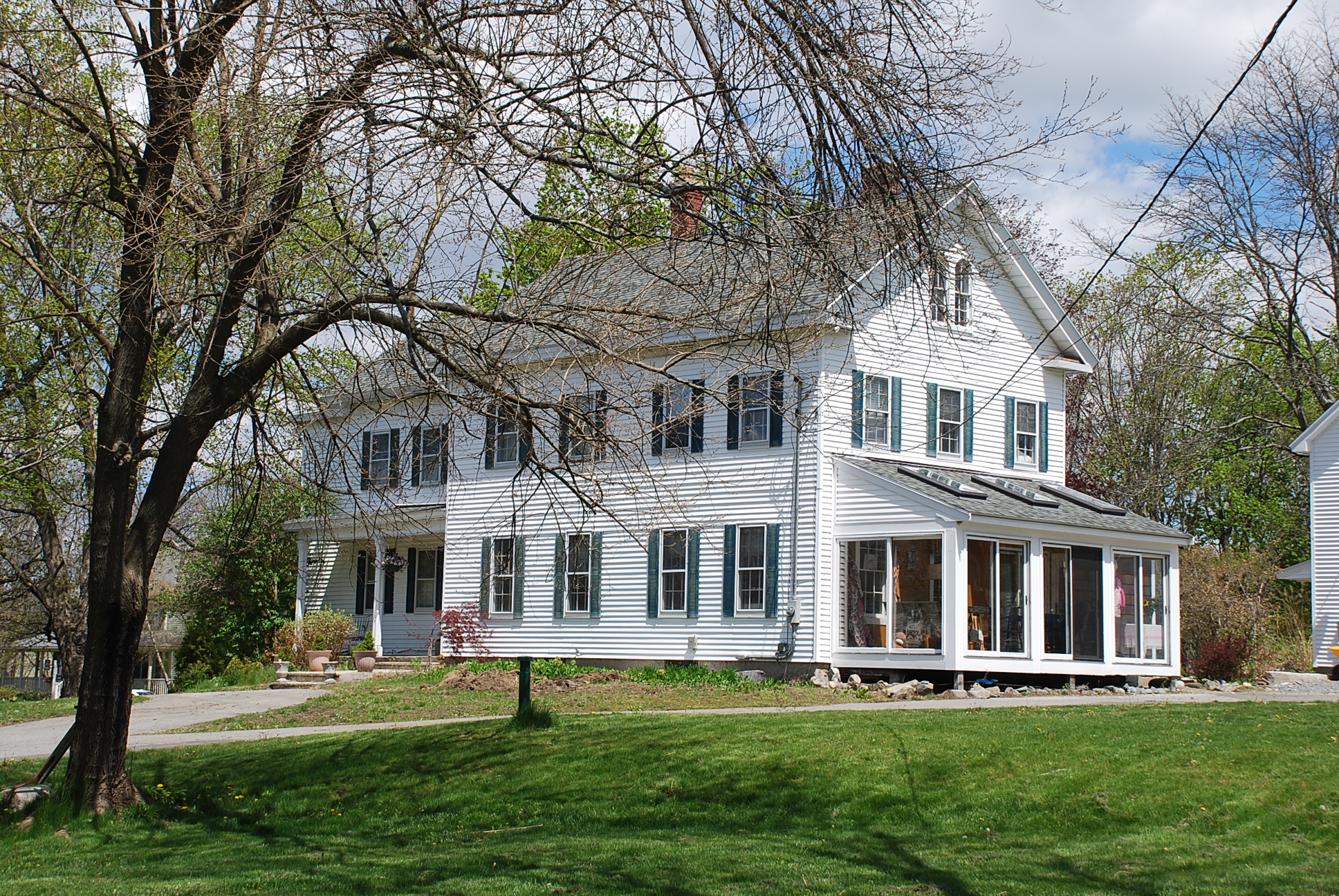
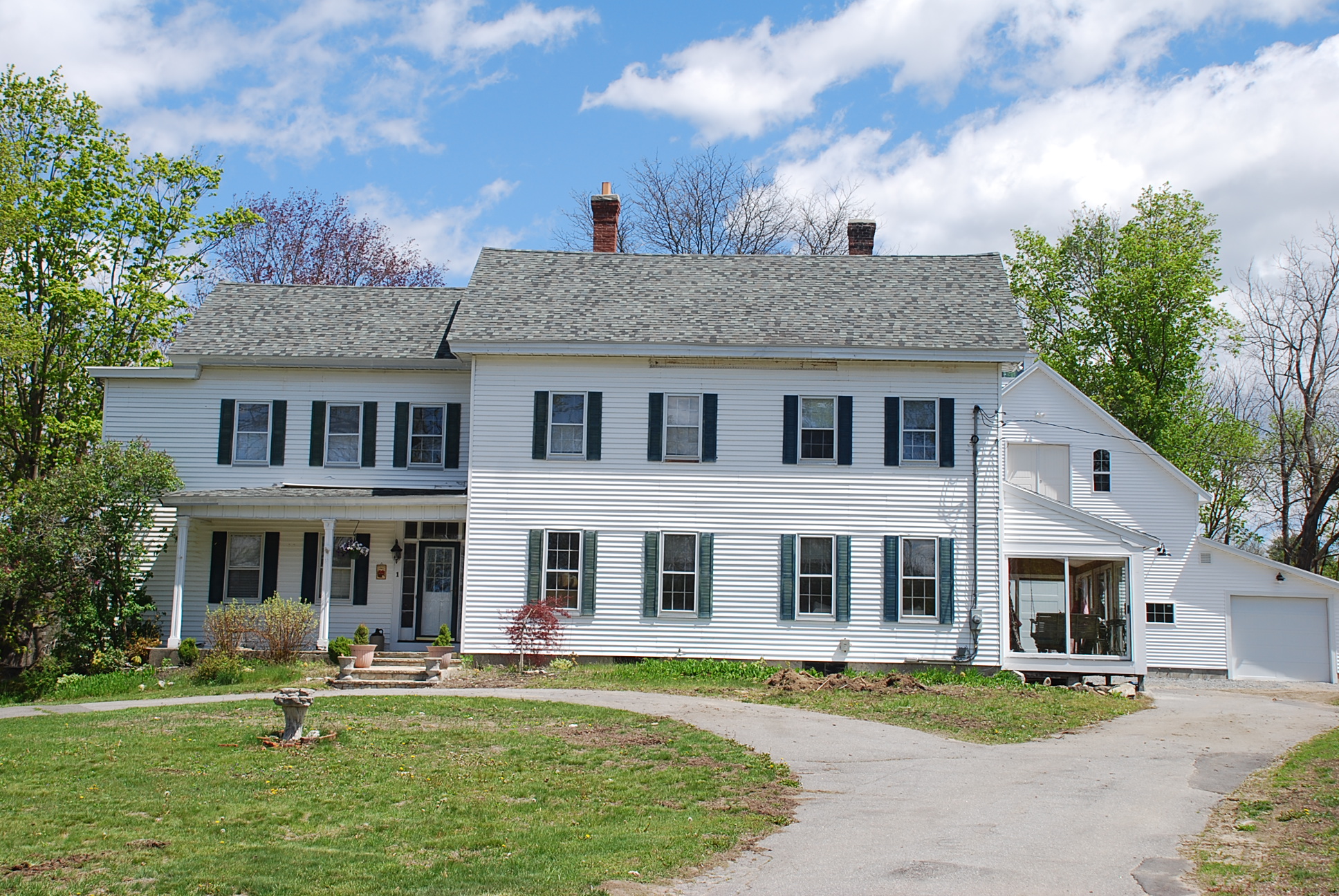
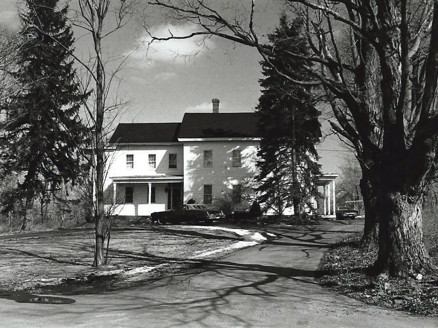
Architectural Description:
2 1/2-story main block with rear ell; main block has gable returns, 6/6 sash, 2 rounded arched gable windows, Victorian double doors & porch; ell has offset Greek Revival doorway w/ sidelights & transom, 6/6 window sash
Historical Narrative:
Themes: Architectural and Community Development
Present owner: 1975 - Asoian, John and Rose
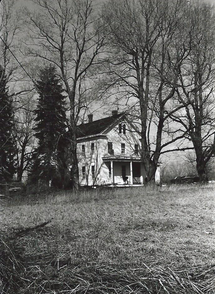
Historical significance: Largely intact setting at rural crossroads.
Interesting and well-done architectural evolution. Greek Revival doorway is particularly striking; new siding has caused major loss of window trim.
This property was formerly owned by Elijah M. Read and contained about 59 acres extending down to River Rd. With the death of Elijah M. Read his estate was administered by John Davis Executor via Probate Court on Feb. 11, 1879. Davis then sold the property to Samuel Hyde Boutwell on Jan. 24, 1884. Boutwell also acquired land from Edward & George Hyde on Oct. 27, 1881 which included woodland on High Plain Rd. It appears that two homes were built on the Boutwell farm, this home being the first and the second home at 9 Pleasant St. The 1852 Map of Andover does not show a house at this location.
In the 1870 Andover Valuation schedule Samuel H. Boutwell is assessed; House $1700, Barn and shed $750, 51 acres land $2300, 8 acres Abbott land $150 and a 3 acre meadow in West Ctr. District $50. Farm Stock $490. The 1872 map does show a home in this location marked S. Boutwell.
Samuel Hyde Boutwell b. March 25, 1838 Andover, MA son of George & Fanny (Hyde) Boutwell. Samuel graduated from Phillips Academy and was a farmer in the Bailey District of West Andover at the junction of Haggetts Pond Rd. & Pleasant Street. Samuel married on Jan. 12, 1865 in Tewksbury to Alice Jane “Jennie” Trull b. September 1840. At some point in the 1890s, Samuel built the second home to the west at 9 Pleasant St.
Samuel was active in town affairs as Selectman for over 20 years. During his term of office “nearly all of the town improvements: macadam roads, sewer, water, gas, street railways, concrete sidewalks, electric lighting, and parks were made.” He served for 25 years as trustee of the Punchard High School and was also on the School Committee for several years. Samuel served at the State level as Representative to the General Court in 1874 and 1910. Samuel joined the West Parish Church in January 1858 (#473). He was church Moderator five times, assessor in 1867, 1885-1891 & 1896- 1903 and a Deacon from 1887-1919. Samuel died October 8, 1919 at 81 years in Andover at 61 Chestnut St., the home of his son Frederic. S. Boutwell. His wife Jennie died on Apr. 7, 1915 at age 74. Samuel & Jennie are interred at West Parish Cemetery in the Boutwell family lot section N lot 3.
Children;
Frederic Samuel - b. Oct. 30, 1865 - d. Feb. 1939 unmarried
Arthur Trull - b. May 3, 1868 - d. Sept. 3, 1940 - m. Susan Molther
Chester Nathaniel - b. Apr. 13, 1870 - d. Aug. 13, 1933 - m. Abbie T. Fessenden
Winthrop Sherman - b. June 13, 1874 - d. 1964 m. Florence B.
Alice Jane - b. June 1879 - d. Oct. 4, 1941
The Boutwell children were the heirs to the property and sold to their brother Chester N. Boutwell on Mar. 26, 1925. Chester b. Apr. 13, 1870 married Abbie T. Fessenden and they had three children. Everett S., Emma B. and Esther B. Boutwell. Chester died on Aug. 13, 1933 at age 63y. His widow Abbie and children would later sell the 51 acre farm parcel to John Asoian and Harry Loosigian.
Parcels were sold off and in April 1969 this farm was sub-divided into two parcels; Parcel A of 4.63 acres contained the farmhouse, barn and garages and parcel B. the 42.28 acres to the east of the homestead. Lot A was deeded to John & Rose Asoian on March 10, 1970. In April 1971 Asoian sub-divided the lot again. John died on May 11, 1980 and Rose then sold the property to George John & Karen H. Carpenter. The parcel contained 3.57 acres including the barn and shed. The land was sub-divided in Jan. 1989 creating Kalia Circle with two new house lots to the rear of the house where the barn had stood. The number was then changed to #1 Kalia Circle from #249 Haggetts Pond Road.
Robert M. & Elizabeth E. Bengston purchased the farmhouse on June 25, 1991.
Robert J. & Roxann R. Broughton - Blanchard - June 18, 2014
Bibliography/References:
Essex County Registry Deeds, Salem, MA
Essex Northern Registry Deeds, Lawrence, MA
see also: Barn Survey 1988 - AHS
Map plan #6174 - April 1969 - parcel A - 4.63 acres
plan #6467 - April 1971 - John Asoian lot 2 - 3.57 acres
Plan #11540 - Jan.3, 1989 - #1 Kalia Circle - .5048 acre
Owners:
Elijah M. Read estate, John Davis Extr. - Feb. 11, 1879
Samuel Hyde Boutwell, wife Alice Jennie - Jan. 24, 1884 - b. 75 p. 85
Samuel Hyde Boutwell estate - died Oct. 10, 1919
Boutwell heirs, Frederic S., Arthur T. , Winthrop S., Chester N. and Alice J. Boutwell - 1919
Chester Nathan Boutwell - Mar. 26, 1925 - b. 510 p. 145
Chester N. Boutwell estate - d. Aug. 16, 1933 - Probate #177375
Boutwell heirs, Abbie F., Everett S. Boutwell, Emma B. Cates, Esther B. Griffin - 1933
John Asoian and Harry Loosigian - Sept. 25, 1939 - b. 625 p. 446
Jacob Bagdoian - Mar. 17, 1942 - b. 721 p. 262
Wm. Loosigian, John Asoian, Harry Loosigian - Mar. 17, 1942 - b. 721 p. 263
John Asoian & Harry Loosigian - July 20, 1954 - b. 795 p. 188
John & Rose Asoian - March 10, 1970 - b. 1150 p. 610
John Asoian estate; Rose Asoian heir - May 11, 1980 - Probate #349127
George John & Karen H. Carpenter - b. 1703 p. 201
Robert M. & Elizabeth E. Bengston - June 25, 1991 - b. 3275 p. 138
Robert J. & Roxann R. Broughton - Blanchard - June 18, 2014 - b. 13884 p. 348
Inventory Data:
| Street | Haggetts Pond Rd |
| Place | Bailey District - West Parish - West Andover |
| Historic District | Not Applicable |
| Historic Name | Samuel Hyde Boutwell House |
| Present Use | residential |
| Original Use | residence - farmhouse |
| Construction Date | 1855 -1865 |
| Source | ECRDS, ENRDL, style-njs |
| Architectural Style | Greek Revival |
| Foundation | stone/granite |
| Wall/Trim | clapboard / clad with aluminum clapboard |
| Roof | asphalt - gable |
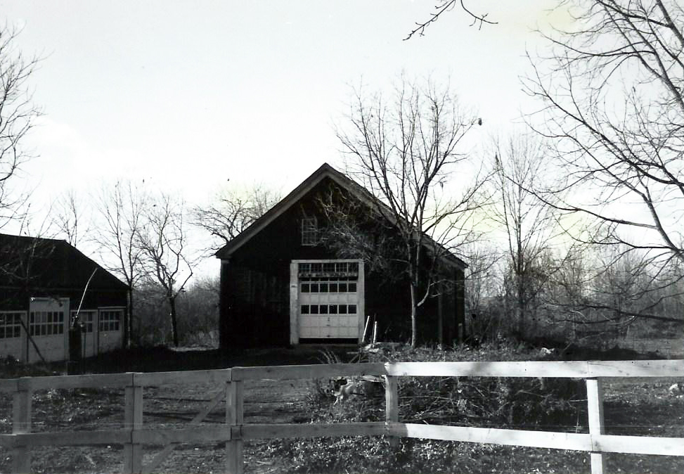
| Outbuildings / Secondary Structures | 2 barns 1980 razed New Barn |
| Major Alterations | doorway, porch, gable windows (1880-1900) |
| Condition | excellent |
| Demolition Details | NE barn demolished (1989) |
| Acreage | 1.3 acres; approx. frontage: 200'; approx. distance from street 90' |
| Setting | residential |
| Map and parcel | 216-8 |
| Recorded by | W. Frontiero, James S. Batchelder |
| Organization | Andover Preservation Commission |
| Date entered | Jun 25 1980, 5/9/2016 |


