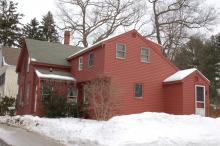
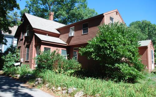
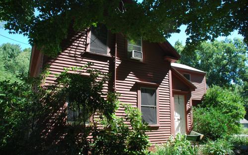
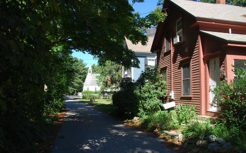
Architectural Description:
Late Greek/Picturesque
basement earth floor
Historical Narrative:
Themes: architectural, community development
In 1990 the street name was changed from High Street in Ballardvale to High Vale Lane to avoid confusion with High Street in Andover Center. In 1958 several streets were re-numbered to plan for future building infill.
Much of High Vale Lane was developed in the late 1870's but this home predates most by thirty years and may have been the first built on the bluff above the Shawsheen River with a view of the mills below and the village that would emerge soon after.
This property and the home next door at 26 High Vale Lane were owned by Henry M. Hayward. Hayward purchased three acres of land on April 3, 1885 for $110 from George J. Tenney of Georgetown, MA. Tenney and Samuel Little were business partners and had acquired this parcel from George Ellis of Boston, but the deed was not recorded at the time of sale. Tenney was a shoe manufacturer. The deed description begins at the land of the Rev. M. J. Murphy, or the St. Joseph's Church parcel and the original end of High Street now High Vale Lane.
Henry M. Hayward and Justin Edwards extended the street in 1891 by creating a right-of-way along the boarders of their two properties. Each man deed a 20' x 900" strip of land creating a 40' wide road southward to the end of thier adjoining properties. It would appear that the homes were built after the right of way. It is possible that this home could have been moved to this location from another property if the construction materials are earlier.
Hayward sold the property to Paul Haeber of Andover on May 24, 1899. Paul may have lived here but later moved to Lawrence, MA and rented the home. In 1938 Haeber created a trust for Marion R. Ludwig, naming Clara E. Ludwig of Lawrence, Trustee. Clare was responsible for collecting all rents, paying taxes and utilities and any income left over was to be given to Marion each December. At the time of Paul's death the property could be sold. Paul died on June 27, 1941. Marion R> Ludwig, now Marion R. Monroe, quit claimed title in the trust and the property was sold to Kenneth E. & Hattie J. Wade on May 11, 1946.
The Wades owned for 28 years and after the death of Kenneth on Feb. 2, 1974, widow Hattie sold the property to Alvin & Janice L. Zink III on April 19, 1974. The Zinks held the property for 22 years then sold by Janice Zink to Brian & Mary M. McCarthy on July 31, 1996.
John E. & Andrea C. Marble purchased the home on June 29, 2001 and continue as owners of record.
Bibliography/References:
Essex County Registry Deeds, Salem, MA
Essex Northern Registry Deeds, Lawrence, MA
Andover maps, 1888, 1906
Owners;
George Ellis of Boston - land
George J. Tenney & Samuel Little of Georgetown, MA - land
Samuel Little estate, heir George J. Tenney, Daniel E. Morton extr. -
Henry M. Hayward - Apr. 3, 1885 - b. 82 p. 486 - $110 - three acres
Henry M. Hayward & Justin Edwards - May 7, 1891 - b. 112 p. 130 - right of way extends High St.
Paul Haeber - May 14, 1899 - b. 168 p. 105
Paul Haeber Trust for Marion R. Ludwig, Clara E. Ludwig, trustee - Mar. 1, 1938 - b. 614 p. 1
Paul Haeber estate, died June 27, 1941
Marion R. (Ludwig) Monroe, quit claim, Clara E. Ludwig, trustee - 1946
Kenneth E. & Hattie J. Wade - May 11, 1946 - b. 684 p. 383
Kenneth E. Wade estate, heir Hattie J. Wade - Feb. 20, 1974 - probate
Alvin & Janice L. Zink, III - April 19, 1974 - b. 1239 p. 332
Janice L. Zink - May 5, 1993 - b. 3722 p. 10
Brian & Mary M. McCarthy - July 31, 1996 - b. 4560 p. 135
John E. & Andrea C. Marble - June 29, 2001 - b. 6227 p. 345
Inventory Data:
| Street | High Vale Ln |
| Place | Ballardvale |
| Historic District | Andover Historic Building Survey |
| Present Use | residence |
| Original Use | residence |
| Construction Date | c.1860's |
| Source | ECRDS, ENRDL, style-njs |
| Architectural Style | Greek Revival |
| Foundation | stone/granite/brick |
| Wall/Trim | clapboards/wood |
| Roof | asphalt - gable |
| Outbuildings / Secondary Structures | modern garage |
| Condition | excellent |
| Acreage | 0.985 acre |
| Setting | residential |
| Map and parcel | 139-54 |
| MHC Number | ANV.261 |
| Recorded by | Stack/Mofford, James S. Batchelder |
| Organization | Andover Preservation Commission |
| Date entered | 1975-77, 12/15/2016 |
