Historical Narrative:
In 1990 the street name was changed from High Street in Ballardvale to High Vale Lane to avoid confusion with High Street in Andover Center. In 1958 several streets were re-numbered to plan for future building infill.
Much of High Vale Lane was developed in the late 1870's but this home predates most by thirty years and may have been the first built on the bluff above the Shawsheen River with a view of the mills below and the village that would emerge soon after.
Henry M. Hayward and Justin Edwards extended the street in 1891 by creating a right-of-way along the boarders of their two properties. Each man deeded a 20' x 900" strip of land creating a 40' wide road southward to the end of their adjoining properties. It would appear that the homes at #28 and #30 were built after the right of way.
Justin Edwards, of Lowell, MA had acquired an eight acre wooded parcel of land from family members and sold the property to Charles W Richardson, wife Agnes on March 9, 1911. Edwards was a decedent of the Rev. Justin Edwards and wife Lydia who made their home at 71 Main St. in Andover in 1819. The Edwards home was razed in 1930 for the construction of the Andover Post Office building.
Richardson built the home and lived here eight years. He sold the house with 4.1 acres to James Smyth and wife Martha R. on Aug. 14, 1919. The 1920 Andover Valuation schedule lists Symith property as house, Hugh St. $1300, 4.1 acres land $200. Smyth owned just three years then selling to Emery J. Trott on Sept. 30, 1922. Trott owned for seven years then sold to John S. & Marion F. Gollan on March 9, 1929.
The "Great Depression" took its toll on many families in Andover and the country. The Andover Savings Bank held the mortgage deed and took possession in March 1939. The property was then sold to Robert A. & Sarah Holt Brown on April 29, 1939. The Brown family held the property for five years then selling to Charles H. & Antonia J. Murnane of Ballardvale. Murnane owned for ten years.
John J. & Elizabeth H. Provasoli purchased the home on July 22, 1954. The home remained in the family for 55 years. John J. b. 1914 was a foreman and wife Elizabeth b. 1922 a housewife. John & Elizabeth had four children, John J., Joseph, Debra J. and Cheryll A. John died on Dec. 7, 2007 and wife Elizabeth on Feb. 1, 2009. The estate was settled by their children and sold to Philip J. Snyder and Briana R. Salak on Aug. 14, 2009.
Bibliography/References:
Essex County Registry Deeds, Salem, MA
Essex Northern Registry Deeds, Lawrence, MA
Andover maps, 1888, 1906
Map plan #6327 - Sept. 24, 1970 - land taking for South School
Town of Andover - Jan. 22, 1971 - b. 1165 p. 381
Owners;
Justin Edwards
Charles W> Richardson - March 9, 1911 - b. 302 p. 323 - Eight acres
James Smyth, wife Martha R. - Aug. 14, 1919 - b. 405 p. 519
Emery J. Trott - Sept. 30, 1922 - b. 465 p. 543
John S. & Marion F. Gollan - Mar. 9, 1929 - b. 545 p. 59
Andover Savings Bank - Mar. 13, 1939 - b. 621 p. 554 - mtg. deed
Robert A. & Sarah Holt Brown - Apr. 29, 1939 - b. 622 p. 54
Charles H. & Antonia J. Murnane - Oct. 4, 1944 - b. 668 p. 247
John J. & Elizabeth H. Provasoli - July 22, 1954 - b. 795 p. 138
John J. Provasoli estate, Elizabeth H. Provasoli, heir - Dec. 5, 2007 -
Elizabeth H. Provasoli, estate, John J. Provasoli jr, Debra J. Merrill, Extrs. - Feb. 1, 2009
Philip J. Snyder & Briana Rae Salak - Aug. 14, 2009 - b. 11732 p. 318
Philip J. & Briana R. Snyder - June 22, 2012 - b. 12993 p. 275
Inventory Data:
| Street | High Vale Ln |
| Place | Ballardvale |
| Historic District | Andover Historic Building Survey |
| Historic Name | Richardson - Provasoli house |
| Present Use | residence |
| Original Use | residence |
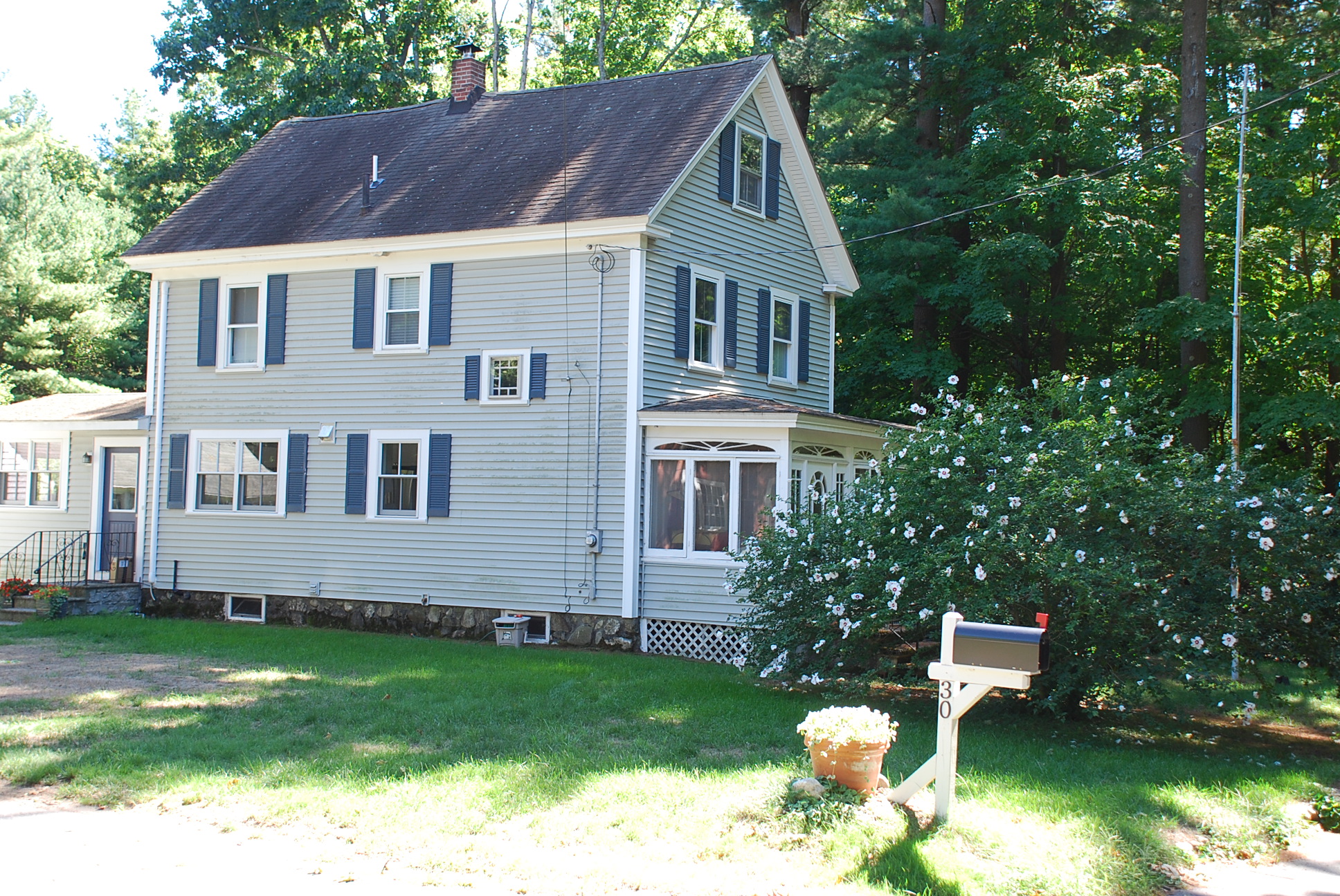
| Construction Date | 1911 |
| Source | ECRDS, ENRDL, style-njs |
| Architectural Style | Other |
| Foundation | stone/granite |
| Wall/Trim | clapboard/wood/vinyl siding |
| Roof | asphalt - gable |
| Major Alterations | replacement windows, vinyl siding. |
| Condition | excellent |
| Acreage | 1.87 acres |
| Setting | residential |
| Map and parcel | 139-55 |
| Recorded by | James S. Batchelder |
| Organization | Andover Preservation Commission |
| Date entered | Dec. 16, 2016 |

