Architectural Description:
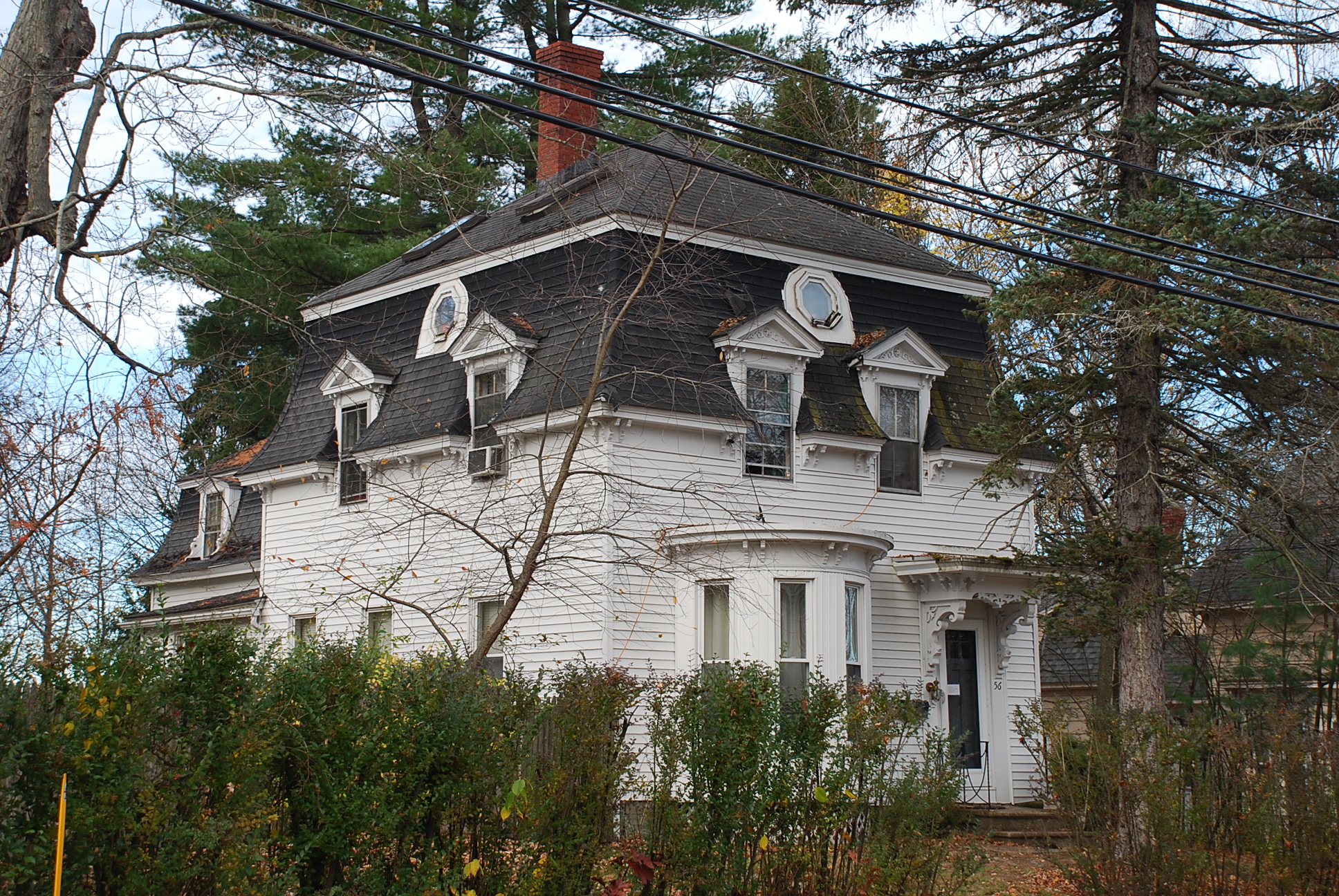
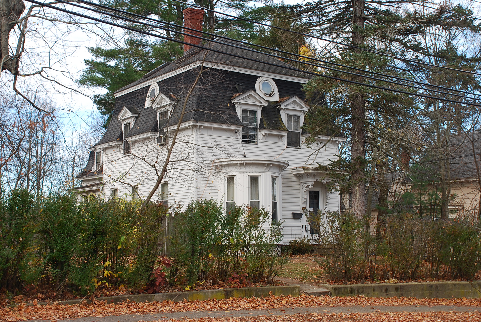
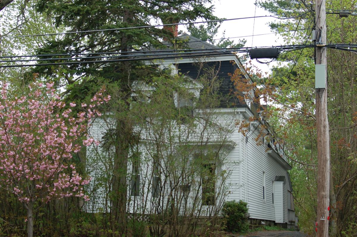
French Empire - Second Empire style, unusual semi-circular bay on front; mansard roof, double bracketed eaves, detailed scroll brackets support front door hood. scroll work in gables of roof dormers. Octagonal window a 1990's addition and not original to house.
Historical Narrative:
Themes: Architectural; community development
This property was once owned by William S. Jenkins in 1868. Jenkins was a master carpenter and business partner with Clement & Jenkins on Essex St. Jenkins built many fine homes in Andover. It is interesting to note that Jenkins sold this property to George S. Cole, wife Emma on Sept. 24, 1868. George S. Cole was also a carpenter and with his partner Lewis Hardy of Hardy & Cole bought out the Clement & Jenkins business. George Cole lived on Maple Ave. and most likely built this home. The property was sold to Albert S. Manning on April 15, 1871 for $2475. excluding a NW corner of the former lot which had already been sold off.
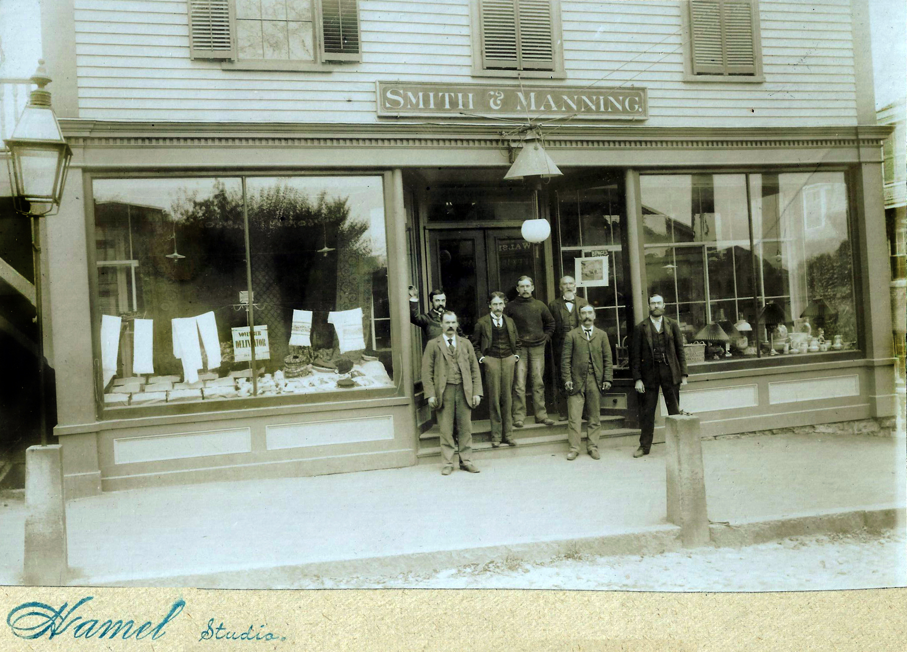
Albert S. Manning was a merchant and partner with John L. Smith and ran one of the most patronized stores in Andover under the name Smith & Manning, Grocers at 10 Essex Street. They worked for H.P. Beard & Co. in that location and when Beard died, unexpectedly, Smith, Manning and Issac S. Carruth purchased the business. The store carried a general line of groceries and dry goods, paper hangings and carpets, a true General Store. Smith & Manning Co. were the longest owners and tenants in the historic building on Essex St.
Manning owned the home for 18 years then sold to Frances A. Flint, wife of John H. Flint. They lived in the former mansion at 8 Elm Street. This was purchased as income property and leased. Flint owned just four years then sold to John E. & Jane S. D. Smith on Sept. 20, 1893.
John Ellsworth Smith was the son of John L. Smith, business partner of Arthur S. Manning. They lived across the street at 55 High St. John E. was born in Feb. 1862, son of John L. & Mary E. (Barker) Smith. John married Mary H. Howarth b. Oct. 1865 daughter of Oberlin B. Howarth. John and Mary had seven children; John L. b. Aug. 1892, Mary E. b. May 1893, Helen S. b. Apr. 1894, Dorothy H. b. Oct. 1895, Wilhelmina B. b. Sept. 1897, Frank L. b. Feb. 1898 and Anna b. 1902.
The 1900 census list John occupation as Superintendent of the Water Works and the 1901 Directory of Andover: John E. Smith, Superintendent of public works for town of Andover. In 1910 Civil engineer for Tyer Rubber Co. Smiths family owned the home for 21 years selling to Arthur E. & Gertrude A. Jones on Oct. 7, 1914.
Bibliography/References:
Essex County Registry Deeds, Salem, MA
Essex Northern Registry Deeds, Lawrence, MA
Andover Maps, 1852, 1872, 1884, 1888, 1906
Andover Directories
Owners:
William S. Jenkins - 1868 - land
George S. Cole, wife Emma B. - Sept. 24, 1868 - b. 757 leaf 4 Salem deed
Albert S. Manning - Apr. 15, 1871 - b. 8 p. 217 - Lawrence deeds
Frances A. Flint, wife of John H. - Oct. 15, 1889 - b. 103 p. 423
John E. & Jane S. D. Smith - Sept. 20, 1893 - b. 128 p. 400
Arthur E. & Gertrude A. Jones - Oct. 7, 1914 - b. 347 p. 162
James S. & Beatrice (Bridget F.) Goodwin - Oct. 17, 1923 - b. 489 p. 150
Fred E. Cheever - Nov. 15, 1956 - b. 845 p. 2
James S. & Beatrice F. Goodwin - Nov. 15, 1956 - b. 845 p. 266 - correction
John S. & Dorothy M. Monroe - Nov. 15, 1956 - b. 845 p. 267
Edgar E. & Sharon A. Joiner, III - Oct. 20, 1972 - b. 1204 p. 746
David G. & Nancy A. Hopwood - Oct. 28, 1980 - b. 1465 p. 201
David G.. Hopwood - March 16, 2009 - b. Mar. 16, 2009 - b. 11504 p. 39
Inventory Data:
| Street | High St |
| Place | Andover Center District |
| Historic District | Andover Historic Building Survey |
| Historic Name | Albert S. Manning House |
| Present Use | residence - 2 family |
| Original Use | residence |
| Construction Date | 1868-1870 |
| Source | ECRDS, ENRDL, style-njs |
| Architectural Style | Second Empire |
| Architect/Builder | George S. Cole |
| Foundation | brick/stone |
| Wall/Trim | clapboard/wood/vinyl siding |
| Roof | asphalt - mansard |
| Major Alterations | Conversion to two family, vinyl siding |
| Condition | excellent |
| Acreage | 0.382 acre; 16, 640 sq. ft. approximate frontage 70' |
| Setting | residential |
| Map and parcel | 38-70 |
| MHC Number | ANV.247 |
| Recorded by | Stack/Mofford, James S. Batchelder |
| Organization | Andover Preservation Commission |
| Date entered | 1975-77, Nov. 2, 2015 |


