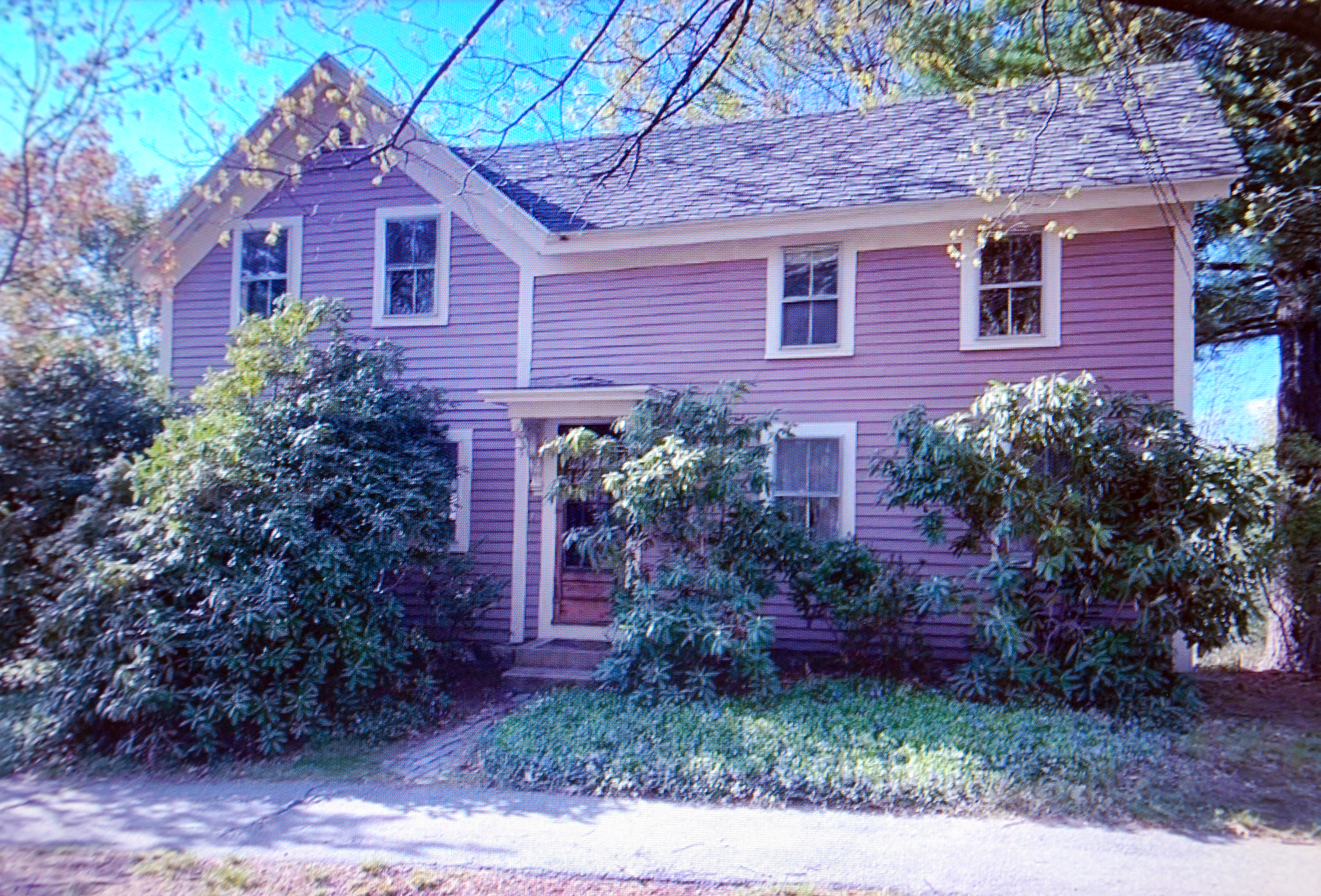
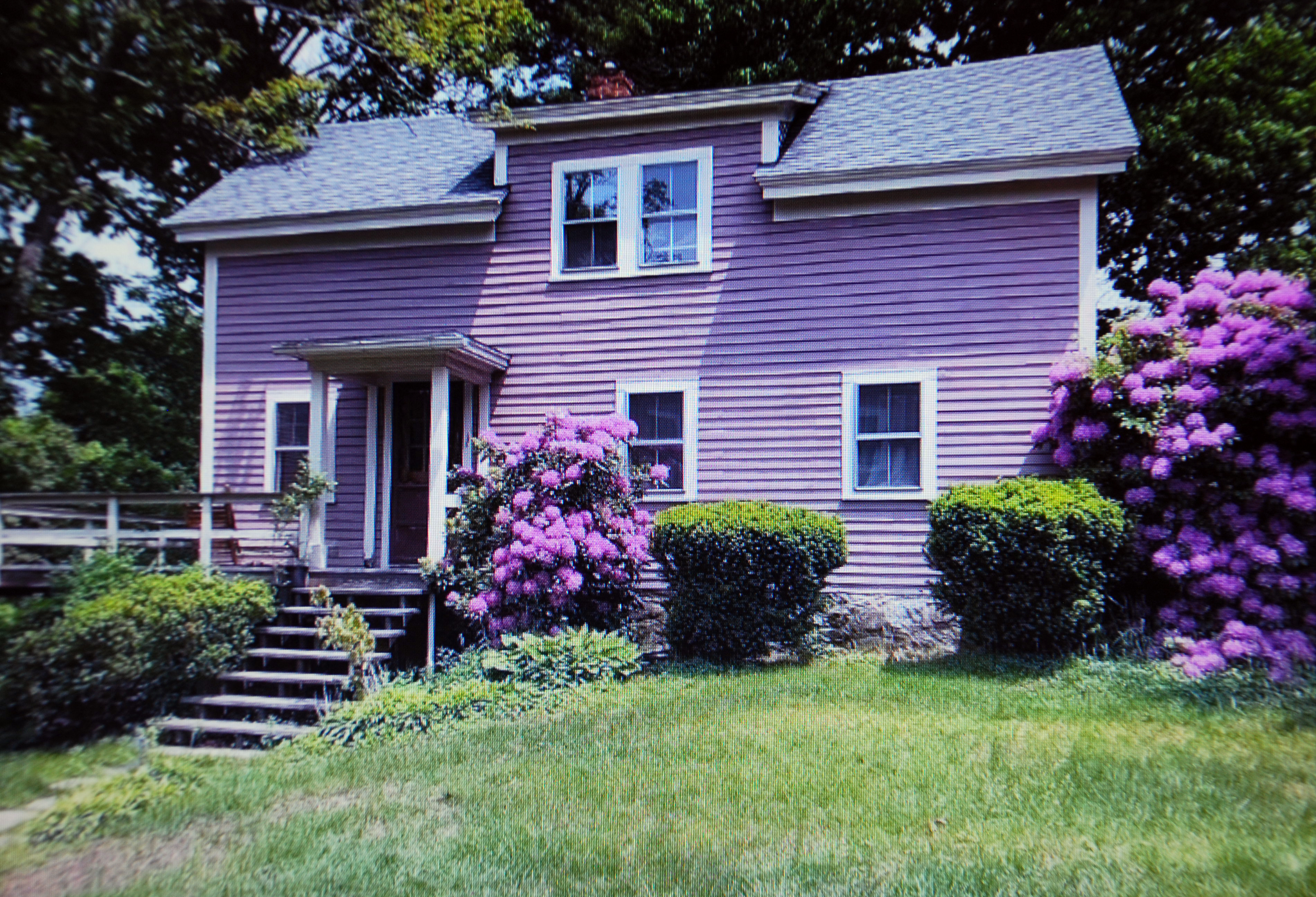
Architectural Description:
This house is similar to several others on this end of Morton St. Built in 1857
Historical Narrative:
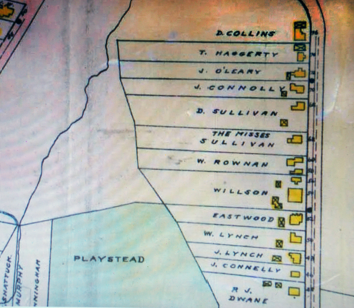
Morton St., east of Main St. was first known as Pike Street or Pike Lane, then Green St. on 1872 maps. Pike and East Pike St. appear on earlier deeds. Morton St. originally began at School St. and ended at Main Street. Morton St. was extended to include Pike in the late 1890’s. Pike also was nick-named "Ram Cat Alley" by local old-timers. The Pike Soap Company was located near the intersection of Bartlet St. and later further east on the south side of the road. It was formerly believed some of the houses on the east end of Morton St. were built by Willard Pike for his employees. Recent research disproves this claim. Most of the modest homes were built for Irish emigrants between 1854 – 1860.
George H. French was a merchant in Andover when he purchased 10 acres 9 rods of land from Phillips Academy on Mar. 8, 1854. The parcel’s south border along Pike Street extended down into what is now the “Playstead” and a portion of the Andover Housing Authority. French subdivided the property into house lots along the street. Each lot sold contained a caveat that the new owner had to build a fence along the property line and maintain their half. French sold a portion of his property to Rev. Varnum Lincoln for $750. Lincoln sold 3 acres to Rogers Sweeney, wife Catherine on June 17, 1857 for $442.50. The lot was 12 rods wide and 40 rods deep (198’ x 660’) extending from Pike St. north down the hill. Sweeney divided the lot and sold to 1 acre Daniel Sullivan a 4 rod x 60 rod parcel (66’ x 660’) of $200 on August 26, 1857. The deed came with a demand that …” he the said Sullivan building a good stone wall all along the line where the lot… joins the land of Varnum Lincoln’s, also a stone wall on the line of my land, and maintain his half, also the right of way on Pike Street.”
Daniel Sullivan was a laborer, born in Ireland in Jan. 1837 and married Mary Welch b. 1845 in Ireland. The 1860 Valuation lists Daniel Sullivan’s property as 1 acre, House and land $300. The 1870 valuation lists house $100, barn $75, 2 acres of land $250 and farm stock $45. The Sullivan family would own the property for 116 years. Daniel purchased a second 1 acre lot adjoining his from Michael Welch on July 26, 1866. The deed however recorded his name as David and not Daniel and an affidavit in 1954 corrected the error.
Daniel & Mary had eight children; Margaret b. 1858, John C. b. June 22, 1861, Ellen Agnes b. 1863, Isabella b. 1864, Daniel b. Dec. 6, 1866, Mary Ann b. Mar. 3, 1869, Michael F. b. Oct. 15, 1870 and Patrick b. Jan. 21, 1873.
The 1900 Census lists Daniel, Mary and three children Dau. Mary Ann, a dressmaker, Michael, a garden laborer and Patrick a Coachman. Daniel Sr. died on Feb. 24, 1907 at age 70 and is interred at St. Augustine’s Cemetery. His estate went to wife Mary and their six surviving children, Patrick A., Daniel A, John J., Michael F., Ellen “Nellie” A. and Mary A. Sullivan. The 1910 Census lists Mary age 60, Mary A. dressmaker 40, and Michael labored 39 and her grandson Bernard age 6. Son Daniel A. died on May 22, 1911. Widow Mary died on Nov. 29, 1922 the estate went to her remaining five children.
A small parcel of the property was sub-divided off in 1910 (#64 Morton) and deeded to their son Patrick A. Sullivan. That home first appears in the 1916 Directory listing Patrick, a gardener and wife Ellen.
Siblings Michael and Mary Ann Sullivan remained in the homestead with their nephew Bernard. Bernard Augustine Sullivan was born July 8, 1903 in Andover, son of Patrick A. & Ellen M (Kelly) Sullivan. Bernard graduated from Phillips Academy, was a clerk for the American Woolen Co. He married Sept. 3, 1937 in Lawrence to Madeline F. LaCouta, b. Mar. 31, 1907 dau. of George W. & Sarah F. (Duffy) LaCouta and they had one daughter Maureen b. Mar. 14, 1944.
Uncle Michael died in 1943 and Mary Ann inherits homestead. Mary A. adds Bernard’s name on the deed in 1951 and then deeds the property to Bernard and Madeline on Mar. 8, 1954. Mary A. died Dec. 21, 1957. Bernard died on Nov. 24, 1972 and is interred in the Sullivan lot at St. Augustine’s Cemetery. Madeline sold the property to James R. & Judy A. Lynch on Mar. 20, 1973.
Both Jim and Judy (Chamberlin) Lynch were Andover natives. Jim was a firefighter and Judy worked for the Andover Credit Union.
Bibliography/References:
68 Morton Street – 40-83 – 0.820 acres
Daniel & Mary Sullivan House – Circa 1858
Plan 461
Affidavit – Mary A. Sullivan – on 2nd parcel – June 1954 – b. 4084 p. 316 Salem Deeds.
Owners:
George H. French -
Varnum Lincoln –Mar. 8, 1854 – b. 490 leaf 237 - $750 land on Pike St.
Roger Sweeney – June 19, 1857 – b. 554 leaf 281 - $442.50
Daniel Sullivan – Aug. 26, 1857 – b. 564 leaf 204 - $200 lot
Daniel Sullivan – July 26, 1866 – b. 707 leaf 263 - $200 2nd lot adjoining.
Daniel Sullivan estate, wife Mary – Feb. 24, 1907 – Probate #100,760
Mary Sullivan estate, heirs – Nov. 29, 1922 – Probate #144,243
Sullivan heirs, children & grandchildren
Michael F. Sullivan estate, May 29, 1943 – Probate #206,642
Mary A. Sullivan – Sept. 30, 1943 – b. 670 p. 342
Mary A. Sullivan – Jan. 2, 1951 – Doc. 13516 – land court
Michael Casey - Jan. 12, 1951 – b. 746 p. 179 – deed change
Mary A. Sullivan and Bernard A. Sullivan – Jan. 12, 1951 – b. 746 p. 180
Mary G. Lyons – Mar. 8, 1954 – b. 788 p. 366 deed change
Bernard A. & Madeline Sullivan – Mar. 8, 1954 – b. 788 p. 367
Bernard A. Sullivan estate, Heir Madeline – Nov. 24, 1972 – Probate
James R. & Judy A. Lynch – Mar. 20, 1973 – b. 1214 p. 267
Samuel W. & Gail (Delaney) Woolford – Nov. 30, 1984 – b. 1899 p. 35
John W. Jr. & Laurel Kuipers – Aug. 9, 1988 – b. 2784 p. 140
John W. & A. Laurel Kuipers – Aug. 4, 1992 – b. 3517 p. 333
Caleb Harty – June 29, 2021 –
Inventory Data:
| Street | Morton St |
| Place | Andover Center District |
| Historic District | Andover Historic Building Survey |
| Historic Name | Daniel & Mary Sullivan House |
| Present Use | residence |
| Original Use | residence |
| Construction Date | 1857 |
| Source | ECRDS, ENRDL, style-njs |
| Architectural Style | Other |
| Foundation | stone & granite |
| Wall/Trim | Clapboard/wood |
| Roof | asphalt/gable |
| Outbuildings / Secondary Structures | Barn/garage on west line on property. |
| Condition | excellent |
| Acreage | 0.820 acre |
| Setting | residential |
| Map and parcel | 40-83 |
| Recorded by | Karen Herman, James S. Batchelder |
| Organization | Andover Preservation Commission |
| Date entered | 2010, 7/24/2021 |


