Historical Narrative:
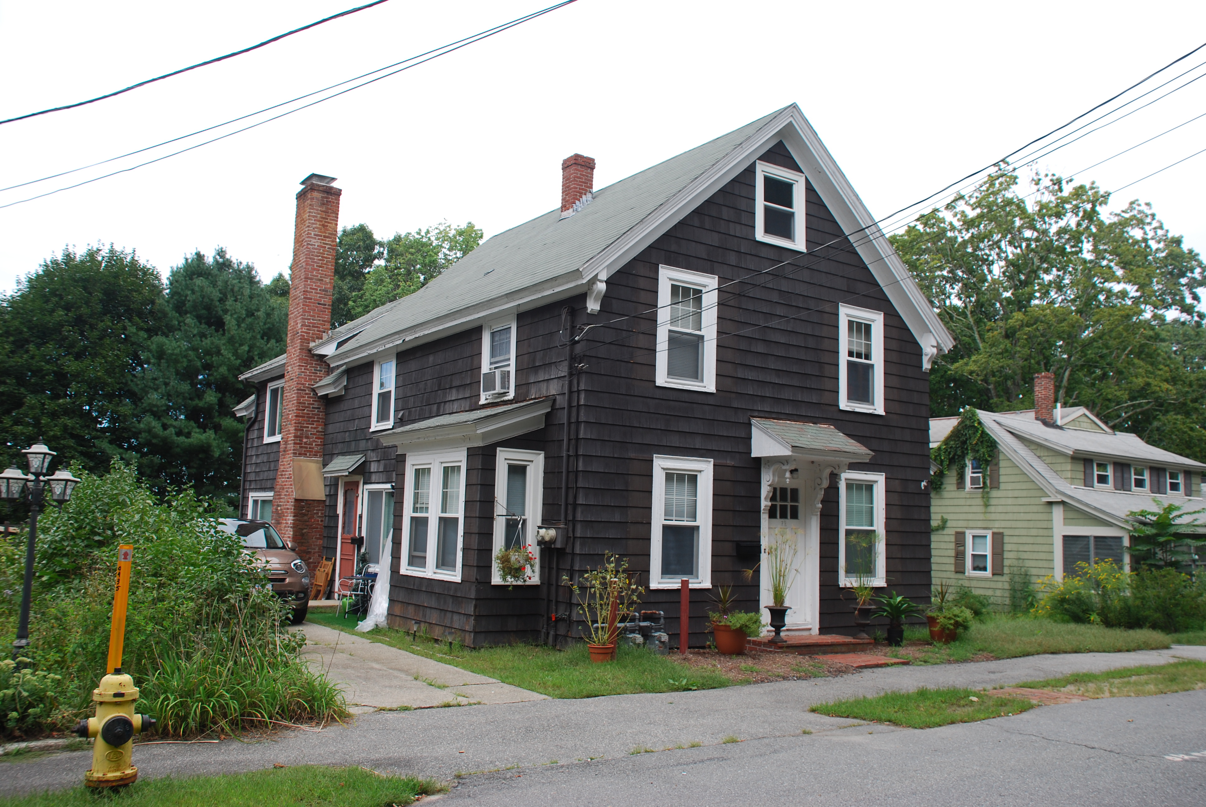
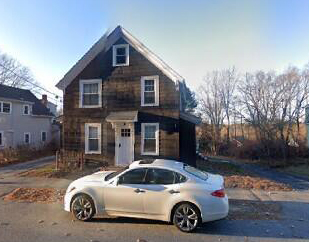
72 Morton Street – 22-108 – 0.249 acre -built 1859-60
Jeremiah & Catherine Leary House – (two family)
Morton St., east of Main St. was first known as Pike Street or Pike Lane, then Green St. on 1872 maps. Pike and East Pike St. appear on earlier deeds. Morton St. originally began at School St. and ended at Main Street. Morton St. was extended to include Pike in the late 1890’s. Pike also was nick-named "Ram Cat Alley" by local old-timers. The Pike Soap Company was located near the intersection of Bartlet St. and later further east on the south side of the road. It was formerly believed some of the houses on the east end of Morton St. were built by Willard Pike for his employees. Recent research disproves this claim. Most of the modest homes were built for Irish emigrants between 1854 – 1860.
George H. French was a merchant in Andover when he purchased 10 acres 9 rods of land from Phillips Academy on Mar. 8, 1854. The parcel’s south border along Pike Street extended down into what is now the “Playstead” and a portion of the Andover Housing Authority. French subdivided the property into house lots along the street. Each lot sold contained a caveat that the new owner had to build a fence along the property line and maintain their half. French sold a portion of his property to Rev. Varnum Lincoln for $750. Lincoln sold 3 acres to Francis Williamson June 19, 1857 for $442.50.
Williams then sold off one acre to Thomas Murphy on Oct. 1, 1859 for $200. It appears that Murphy built a house on the property. The Andover Valuation of 1860 lists: Thomas Murphy 1 acre House & Land $300.
Jeremiah Leary purchased the house on at 72 Morton St. on Oct. 1, 1861 from Thomas Murphy. Jerri and Catherine had eleven children; Annie b. Dec. 8, 1860, Mary A. b. May 10, 1862, Michael b. Aug. 7, 1865, John Henry b. Feb. 4, 1867, Catherine b. June 29, 1868 – d. 5/3/1876, Margaret E. b. June 20, 1870, Hanora “Dora” b. Jan 8, 1874, Elizabeth “Lizzie” b. Nov. 16, 1875 and Agnes b. Mar. 4, 1878.
The 1920 Census lists Jeremiah age 78, Catherine 80 and daughter Elizabeth age 33 an operator in the Flax Mill Smith & Dove Manufacturing Co. in Abbott Village, Andover. Jeremiah died in 1923.
The property remained with the Leary family for 75 years. The home was rented out after their parents died. The heirs sold to Clinton H. & Edith M. Stevens on Nov. 14, 1936.
Bibliography/References:
Essex County Registry of deeds, Salem
Essex, Northern Registry Deeds, Lawrence
Andover Maps. 1855, 1872, 1888, 1906
Andover Resident Directories
Andover Valuation Schedules, 1850, 1860, 1870, 1900
Andover Vital Statistics
Andover Townsman Obituaries.
Ancestry.com. Family Genealogies, US & State Census records,
Owners;
Trustees of Phillips Academy –
George H. French – Feb. 15, 1854 - b.491 leaf 123 - $750 – 10 acres 9 rods
Varnum Lincoln – March 8, 1854 – b. 490 leaf 237 - $750
Francis Williamson, wife Margaret – June 19, 1857 – b. 554 leaf 280 – 3 acres - $442.50
Thomas Murphy, wife Mary – Oct. 1, 1859 – b. 596 leaf 144 – 1 acre $200
Jeremiah Lary (Leary, O’Leary) – Oct. 1, 1861 rec. Dec. 10, 1863 – b. 659 leaf 259
Catherine Leary estate, Jeremiah Leary – Probate #144615
Jeremiah Leary estate, 1923, Heirs children – Probate #144617
Clinton H. & Edith M. Stevens – Nov. 14, 1936 – b. 608 p. 73
Clinton H. Stevens estate, Edith M. heir –
Charles W. & Helen West – b. June 17, 1965 – b. 1036 p. 104
Charles W. West estate, Helen heir – Jan. 8, 1988
72 Morton St. Realty Trust, Kimberly Ann West Tr. 0 June 9, 1993 – b. 3751 p. 166
Inventory Data:
| Street | Morton St |
| Place | Andover Center |
| Historic District | Andover Historic Building Survey |
| Historic Name | Jeremiah & Catherine Leary House |
| Present Use | residence - 2 family |
| Original Use | residence |
| Construction Date | 1859-1860 |
| Source | ECRDS, ENRDL, style-njs |
| Architectural Style | Other |
| Foundation | stone/granite/brick |
| Wall/Trim | Clapboard/wood |
| Roof | asphalt/gable |
| Major Alterations | conversion to two family home |
| Condition | good |
| Acreage | 0.249 acre |
| Setting | residential |
| Map and parcel | 22-108 |
| Recorded by | James S. Batchelder |
| Organization | Andover Preservation Commission |
| Date entered | 7/26/2021 |


